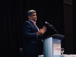
• facebook
  • Twitter
  • Linkedin
  • Youtube
  • Linkedin Group
  • Post a Job
  • Post an Ad
  • Post an Event
  • Post a Directory Listing
  • Post a Press Release
  • Media Kit
  • My Account
  • Login
GoGeomatics
  • MAGAZINE
    • BIM & GIS
    • Community
    • Conference news
    • Earth Observation
    • Education & Careers
    • GEOAI
    • Announcements
    • Reality Capture & Lidar
    • Science
    • Technology
  • Directories
    • ASSOCIATION
    • INDUSTRY
    • EDUCATION
    • Open Data
  • EVENTS
    • GeoIgnite Events
    • Events Calendar
    • GoGeomatics Meetups
  • Services
    • Advertising
    • Marketing
    • Post a Job
    • Post an Ad
    • Post an Event
    • Post a Press Release
    • Post a Directory Listing
    • Media Kit
    • Web Design
  • Find a Job
  • Volunteer
    • Start a GoGeomatics Group
    • Editors & Writers Group
  • About Us
    • About Us
    • Contact Us
    • Frequently Asked Questions
  • Videos
HomeCCMEO

CCMEO

||||
Community

Leadership in Times of Disruption: GeoIgnite 2020 talks at a Glance

13 July 2020 Saeideh Hejazi | Aboriginal

Canada’s geospatial community is gathering next week for GeoIgnite 2020. The second annual conference is being held online this year from the 22nd to the 24th of July. The theme for 2020 is: Leadership in […]

||||||||||||||||||||
Newsmakers & Press Releases

Eric Loubier -DG- CCMEO Keynote Announcement GeoIgnite 2020 Online

24 June 2020 Jon Murphy | 2020

The GeoIgnite conference committee is excited to announce our keynote is the Director General, Eric Loubier, Canada Centre of Mapping and Earth Observation (CCMEO/NRCan).  This is Canada’s National Geospatial Leadership event July 22-24, 2020. Eric […]

||||||||||||||||||
Community

GeoIgnite 2019: 3 weeks away

27 May 2019 Jon Murphy | Canada

The last month has been a lot of fun and a lot of work. Now that we are just weeks away from our first national conference and everything is coming together. First, the support from […]

|||||
Community

GeoIgnite 2019 Conference Interview with Jonathan Murphy

12 February 2019 T Mackinnon | Canada

You may have heard that GoGeomatics Canada is hosting a National Conference called GeoIgnite in Ottawa, from June 18th to 19th. This inaugural event will bring together senior members of the government, business executives, and […]

|||||
Technology

Your Canadian Geospatial Briefing for February 4th: Acadia; AI Centre; Exploring Earth; Canadian caribou; automated vehicles

4 February 2019 GoGeomatics Canada | acadia

Below the surface In a previous digest we introduced the ground-penetrating radar team surveying the historic site of Fort Anne. The group recently discovered what they believe to be the graves of as many as […]

||||
Technology

Canada’s National Elevation Data Strategy Updates from NRCan

24 January 2019 David Belanger | acquisitions

New Data Generated from LiDAR! Natural Resources Canada (NRCan) is proud to announce a new release of the product High Resolution Digital Elevation Model (HRDEM). This new and highly accurate data covers approximately 50,000 km2 […]

Community

NRCan Launches new interactive Map honouring Canadians who fought for our freedom and democracy

12 November 2018 GoGeomatics Canada | Canada

Many places throughout our country are named to remember the actions of Canadians in the defence of freedom and democracy. This interactive map shows how we remember them – eternally tying them to the lands, […]

|||||
Technology

Your Canadian Geospatial Briefing for November 13th: NRCan and OGC; RASC; Concordia University; Canada’s Commemorative Map; IN-FLIGHT Data

11 November 2018 GoGeomatics Canada | Canada

NRCan becomes OGC strategic member GeoConnections of Natural Resources Canada (NRCan) has upgraded to the highest level of membership—strategic member—in the Open Geospatial Consortium (OGC). NRCan has historically contributed to new standards that made geospatial […]

Posts pagination

« 1 … 3 4 5 … 7 »

Events

Notice
There are no upcoming events.

View All Events

Services

  • Post a Job
  • Post an Ad
  • Post an Event
  • Post a Directory Listing
  • Post a Press Release
  • Media Kit
  • My Account
  • Login

Jobs

Post a Job
  • Canada Maps and Poster Gallery Volunteer Leads — GeoIgnite 2026
    remote
  • GIS & Data Analytics Lead
    Beaumont, AB
  • Lead Surveyor, Projects/Arpenteur-géomètre principal, projets; arpenteuse-géomètre principale, projets
    North Bay, Thunder Bay
  • Senior GIS Developer
    Calgary, AB
View All Jobs
  • Directories
    • Associations Directory
    • Industry Directory
    • Education Programs
    • Open Data
  • Volunteer
    • Start a GoGeomatics Group
    • Editors & Writers Group
  • About Us
    • GoGeomatics Media Kit
    • Who We Are
    • Contact Us
    • FAQ’s
    • Advertising
    • Marketing
  • Subscribe
GoGeomatics
GoGeomatics is the largest and most popular communications hub promoting the Canadian geospatial community. The business was incorporated in 2011. GoGeomatics hosts over 100 fun, free, location technology networking events each year in cities across Canada.

© 2025 GoGeomatics

  • facebook
  • Twitter
  • Linkedin
  • Youtube
  • Linkedin Group