Newsmakers & Press Releases
what3words adopted by six national mapping agencies
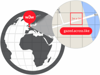
what3words, the multi-award winning location reference system, has today announced that six national mapping agencies have adopted 3-word addresses. Used to input and share locations within national online geoportals, what3words is making it simpler for […]
