Community
Ground Truthing
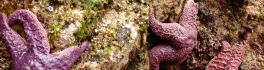
In the world of Remote Sensing, one of the key concepts is ground truthing. This has both a positional component, as well as a field verification of the land cover. These complementary activities are important […]
In the world of Remote Sensing, one of the key concepts is ground truthing. This has both a positional component, as well as a field verification of the land cover. These complementary activities are important […]

Enterprise implementation of geospatial platform transforms electric utility operations San Diego, CA, Esri International User Conference – Esri Canada congratulates Nova Scotia Power for receiving the 2015 Esri Special Achievement in GIS (SAG) Award. The […]
Shelly Glover, Minister of Canadian Heritage and Official Languages and Minister responsible for Manitoba, and Manitoba Premier Greg Selinger visited Churchill to announce an investment of $22.1 million to build a highly innovative research facility to […]

As those of you who have tried their hand at OpenStreetMapping know, OSM can quickly turn from a hobby into a full-blown obsession! OpenStreetMap is a free, editable, open access map created by volunteers all […]
Richmond, BC – MacDonald, Dettwiler and Associates Ltd. (“MDA” or the “Company”) (TSX: MDA), a global communications and information company, announced that it has been awarded three contracts with the Malaysian Remote Sensing Agency (MRSA), […]

When we go to the airport, do we really ever consider where we’re going? To most of us, even those who love transportation geography, an airport is a dot on a map. However, Toronto Pearson […]

Students may have just finished hanging up their backpacks for the summer, but here at GoGeomatics, we already have Back to School on the brain. That is, the 2nd Annual GoGeomatics Back to School Social! […]
PredictION is an app that provides transit authorities with a unique approach to engage and inform the public. By making use of General Transit Feed Specifications, PredictION will allow users to predict the impacts of […]