coordinates
Media & Event Sponsors Announced for Canada’s National Geomatics Expo
We are pleased to announce and express our sincere gratitude to the exceptional media and event sponsors supporting the 2024…
The GoGeomatics Expo Welcomes Coordinates & Construction Technology Today as media sponsors
We are thrilled to share that the Coordinates & Construction Technology Today (CTT) are media sponsors for the GoGeomatics Expo…
UAV Surveys – How to Ensure Accuracy and Precision
For the past four years, I’ve been involved with the capture and delivery of data derived from drones. My experience…
Software Development – The Key to Ecere’s Success
It is rare to learn of a GIS company in which much R&D is done up front to create the…
How to Start Your Career in GIS
You are reaching the point of your life where you are finishing up your last year of college or university…
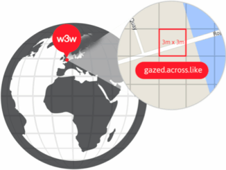
what3words adopted by six national mapping agencies
what3words, the multi-award winning location reference system, has today announced that six national mapping agencies have adopted 3-word addresses. Used…
The Canadian Institute of Geomatics Brings Big Data to Ottawa
Last week I was among an interesting group of participants and presenters who came together to discuss Big Data (June…
Postal Codes: Canada Post Backs Down on Crowdsourced Open Data
Have you ever felt the wrath of a Canadian Crown Corporation? In 2011 Canada Post set its sights on Ervin…
Georeferencing Scanned Maps Using QGIS
One of the passions of modern day information technologists is to convert the past to digital form and to put…
Location Encoding Systems – Could geographic coordinates be replaced and at what cost?
Geocoding is the process of converting a street address into a physical location that can be described with a pair…
Vancouver: Using QGIS TimeManager for Analysis of Crime Data
We typically think of a GIS as features on a map with a maximum of three dimensions: Longitude Latitude Height…
Map Tiles and Cached Map Services
The tiling of large maps is an old practice. Large paper maps have always been divided into a series…