digital
LiDAR in Canada: Conversation with Dr. Chris Hopkinson Research Chair Remote Sensing University of Lethbridge
The author Bob Maher (BM) and Chris Hopkinson (CH) both worked as scientists at the Appied Geomatics Reearch Group (AGRG)…
Airobotics Selects SimActive’s Photogrammetry Software for its Automated Industrial Drone Solution
Montreal, Canada, August 30th, 2016 – SimActive Inc., a world-leading developer of photogrammetry software, is pleased to announce that Airobotics…
Join us for Coast to Coast “Back to School” 2016 GoGeomatics Canada Socials
GoGeomatics Canada is kicking off the new school year this September, and welcoming everyone to our Canada-Wide Back to School…
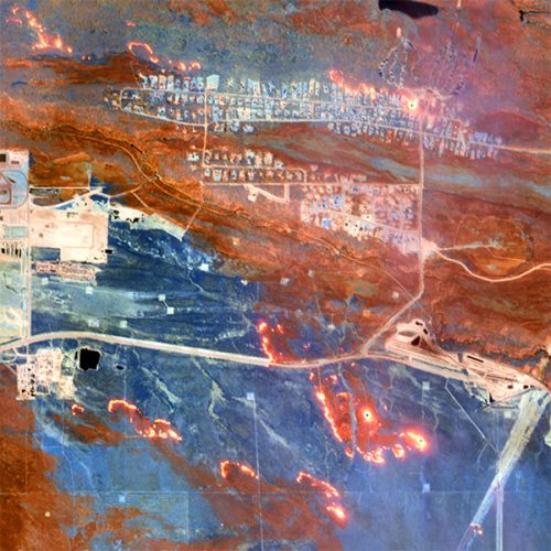
Seeing Through Wildfire Smoke in Fort McMurray, Alberta with Infrared Imaging
Images of the massive wildfire that engulfed Fort McMurray, Alberta earlier this year have been seared into our collective consciousness.…
Canada Takes Part: Arctic Spatial Data Infrastructure Meets in Anchorage
The Arctic SDI Board, which includes mapping executives from Canada, Kingdom of Denmark, Finland, Iceland, Norway, Russia, Sweden and the…
Indoor Mapping Platform Jibestream Named as Fast Growing IoT Company
Toronto: Jibestream announced it has been named among the 30 Fastest Growing IoT Companies for 2016. Improving efficiency, productivity and…
University of Victoria Hosts Advanced Spatial Analysis Course
Is neighbourhood socioeconomic status associated with pediatric and childhood injuries? Are such injuries clustered in space? How can I model…
Countdown to Launch: DigitalGlobe’s WorldView-4 Earth Imaging Satellite
Final preparations are underway at Lockheed Martin to ship DigitalGlobe’s WorldView-4 earth imaging satellite to Vandenberg Air Force Base for…
The Most Fun You’ve had with Geomatics: ‘Pokémon Go’ Comes to Canada
The geospatial community has been “abuzz” since a game called called “Pokémon Go” landed on cell phones in Australia and…
Esri Technical Associate Certification: how I passed the test
A few months ago, I decided to obtain the Esri Associate certification for ArcGIS Desktop and wrote about my reasoning here. …
Conversations with Michael Goodchild on Questions of Geography
Recently, I had the opportunity to sit down with Michael Goodchild and talk about his book and Geography. Michael was…
Drone World Expo Conference Program Will Provide a Road Map for Commercial Drone Solutions
A world-class conference program and several new educational and networking features will take place at the 2nd annual Drone World…


