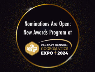
• facebook
  • Twitter
  • Linkedin
  • Youtube
  • Linkedin Group
  • Post a Job
  • Post an Ad
  • Post an Event
  • Post a Directory Listing
  • Post a Press Release
  • Media Kit
  • My Account
  • Login
GoGeomatics
  • MAGAZINE
    • BIM & GIS
    • Community
    • Conference news
    • Earth Observation
    • Education & Careers
    • GEOAI
    • Announcements
    • Reality Capture & Lidar
    • Science
    • Technology
  • Directories
    • ASSOCIATION
    • INDUSTRY
    • EDUCATION
    • Open Data
  • EVENTS
    • GeoIgnite Events
    • Events Calendar
    • GoGeomatics Meetups
  • Services
    • Advertising
    • Marketing
    • Post a Job
    • Post an Ad
    • Post an Event
    • Post a Press Release
    • Post a Directory Listing
    • Media Kit
    • Web Design
  • Find a Job
  • Volunteer
    • Start a GoGeomatics Group
    • Editors & Writers Group
  • About Us
    • About Us
    • Contact Us
    • Frequently Asked Questions
  • Videos
HomeEarth Observation

Earth Observation

Technology

Philippines Granted Access to Canadian Satellites for Dark Vessel Detection

11 October 2023 GoGeomatics Canada | Archaeology GIS

Canada is set to grant the Philippines unrestricted access to cutting-edge satellites, which will enable maritime authorities to closely monitor vessels within the Philippines’ exclusive economic zone, almost in real time. These satellites are capable […]

Technology

International Geospatial Digest September 11th, 2023

11 September 2023 Volunteer Editors and Group Writers | AI

Planning Landmine clearances with UAV LiDAR Mapping pollution from space Tracking dangerous chemicals in the Great Lakes with maps New Google Maps API helps with mapping pollen, solar, and air quality. Understanding geospatial intelligence Planning […]

Community

MAXAR Joins the GoGeomatics Expo

6 September 2023 GoGeomatics Expo | Archaeology GIS

  Maxar partners with innovative businesses and more than 50 governments to monitor global change, deliver broadband communications and advance space operations with capabilities in Space Infrastructure and Earth Intelligence. With more than 60 years […]

Community

Natural Resources Canada (NRCan) Joins the Calgary Geomatics Expo

17 August 2023 GoGeomatics Expo | Archaeology GIS

We are thrilled to announce that Natural Resources Canada will be joining us as an exhibitor and will also be participating in the speaking program at the GoGeomatics Expo, November 6th to 8th, 2023 in […]

Community

The GoGeomatics Expo is Thrilled to share EarthDaily’s participation as a Silver Sponsor & Exhibitor

2 August 2023 GoGeomatics Expo | agriculture

We are glad to break the news that EarthDaily Analytics (EDA) will be participating as both an exhibitor and silver sponsor at the GoGeomatics Expo, taking place in Calgary from November 6th to 8th, 2023! […]

Community

Planet Joins the GoGeomatics Expo in Calgary

26 July 2023 GoGeomatics Expo | agriculture

We are delighted to announce that Planet will be participating as both an exhibitor and a featured speaker at the GoGeomatics Expo, which will take place in Calgary from November 6th to 8th, 2023! Planet […]

Community

Pacific Geomatics (PACGEO) Joins the GoGeomatics Expo Trade Show

7 June 2023 GoGeomatics Canada | Archaeology GIS

GoGeomatics Expo welcomes Pacific Geomatics to the Expo. Pacific Geomatics (PACGEO), knows how critical it is to be confident you have the best satellite imagery for your project. In order to have that assurance, you […]

Technology

International Geospatial Digest May 8th, 2023

8 May 2023 Volunteer Editors and Group Writers | Air Pollution

US neighborhoods with more people of color suffer worse air pollution European Space and Telecoms Players Sign Partnership Agreement Climate change: Satellite maps warming impact on global glaciers The Growing Importance of Location Intelligence UK […]

Posts pagination

« 1 … 18 19 20 … 36 »

Events

Notice
There are no upcoming events.

View All Events

Services

  • Post a Job
  • Post an Ad
  • Post an Event
  • Post a Directory Listing
  • Post a Press Release
  • Media Kit
  • My Account
  • Login

Jobs

Post a Job
  • Canada Maps and Poster Gallery Volunteer Leads — GeoIgnite 2026
    remote
  • Software Engineer – Geographic Information System (GIS)
    Ottawa, ON
  • GIS Data Quality Analyst
    Burnaby, British Columbia
  • GIS Cartographer
    Montreal, QC
View All Jobs
  • Directories
    • Associations Directory
    • Industry Directory
    • Education Programs
    • Open Data
  • Volunteer
    • Start a GoGeomatics Group
    • Editors & Writers Group
  • About Us
    • GoGeomatics Media Kit
    • Who We Are
    • Contact Us
    • FAQ’s
    • Advertising
    • Marketing
  • Subscribe
GoGeomatics
GoGeomatics is the largest and most popular communications hub promoting the Canadian geospatial community. The business was incorporated in 2011. GoGeomatics hosts over 100 fun, free, location technology networking events each year in cities across Canada.

© 2025 GoGeomatics

  • facebook
  • Twitter
  • Linkedin
  • Youtube
  • Linkedin Group