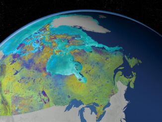
• facebook
  • Twitter
  • Linkedin
  • Youtube
  • Linkedin Group
  • Post a Job
  • Post an Ad
  • Post an Event
  • Post a Directory Listing
  • Post a Press Release
  • Media Kit
  • My Account
  • Login
GoGeomatics
  • MAGAZINE
    • BIM & GIS
    • Community
    • Conference news
    • Earth Observation
    • Education & Careers
    • GEOAI
    • Announcements
    • Reality Capture & Lidar
    • Science
    • Technology
  • Directories
    • ASSOCIATION
    • INDUSTRY
    • EDUCATION
    • Open Data
  • EVENTS
    • GeoIgnite Events
    • Events Calendar
    • GoGeomatics Meetups
  • Services
    • Advertising
    • Marketing
    • Post a Job
    • Post an Ad
    • Post an Event
    • Post a Press Release
    • Post a Directory Listing
    • Media Kit
    • Web Design
  • Find a Job
  • Volunteer
    • Start a GoGeomatics Group
    • Editors & Writers Group
  • About Us
    • About Us
    • Contact Us
    • Frequently Asked Questions
  • Videos
HomeEnvironment

Environment

PCI
Earth Observation

Canadian Space Firm PCI Expands Operations in Scotland

26 June 2025 GoGeomatics Canada | Canada

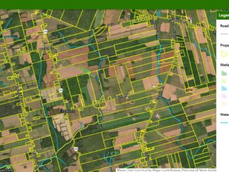
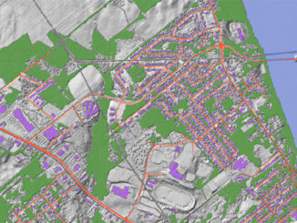
Move underscores Scotland’s rise as a global leader in satellite innovation and Earth Observation, as PCI Geomatics expands its operational footprint. PCI Geomatics (DBA CATALYST), a leading Earth Observation company with over 40 years of […]

BIM & GIS

Telling Stories with Maps: Allen Carroll’s Quiet Cartographic Revolution

25 June 2025 Anusuya Datta | Allen Carroll

Maps Are the Medium. Stories Are the Point. Before the software platforms, before the glossy atlases, there’s a photo. A little boy in pajamas sits between his brother and grandmother. Behind them, pinned to the […]

Earth Observation

Earth Observation, Data Access, and Domestic Capacity: Inside CSA’s 2025–26 Plan

22 June 2025 GoGeomatics Canada | Arctic monitoring

The Canadian Space Agency’s latest spending plan maintains steady funding across its core responsibilities, from satellite operations and space science to robotics and international programs. Within that broader mandate, the plan highlights ongoing investment in […]

BIM & GIS

Preserving Nature’s Balance: How Prince Edward Island Leads with Environmental Mapping

20 June 2025 Alefiya Dungrawala | Canada

The protection of the environment and wildlife is not merely a moral imperative but a critical necessity for sustaining life on Earth. As human activity accelerates climate change, habitat destruction, and species extinction, the balance […]

Other

Taking Control of Canada’s Digital Sovereignty with Open-Source GIS

10 June 2025 Anusuya Datta | Canada

(This is the second part of our series, following the article exploring France’s success with open-source GIS) Canada’s geospatial systems are at a crossroads. Technology is moving fast, and the pressure is on for more efficient, […]

Conference news

Satellite Earth Observation for Mapping and Assessing Terrestrial Water Dynamics

6 June 2025 Benedicta Antwi Boasiako | Canada

At GeoIgnite 2025, Dr. Shusen Wang, Senior Research Scientist at Natural Resources Canada’s Canada Centre for Mapping and Earth Observation (CCMEO), presented a comprehensive overview of using satellite Earth Observation (SEO) for monitoring Canada’s terrestrial […]

Conference news

The Evolution of National Crop Mapping in Canada

6 June 2025 Benedicta Antwi Boasiako | agriculture

At GeoIgnite 2025, Leander Campbell, Acting Lead of the Annual Crop Inventory at Agriculture and Agri-Food Canada (AAFC), delivered an insightful and technically rich presentation on one of Canada’s most important geospatial initiatives: the national […]

VS
Conference news

A Lifetime in Radar: Dr. Vernon Singhroy on Innovation, Influence, and Mentorship

6 June 2025 Benedicta Antwi Boasiako | AI

Dr. Vernon Singhroy is Canada’s one of the most distinguished Earth Observation scientists, known globally for his expertise in Synthetic Aperture Radar (SAR) and remote sensing applications. Over his decades-long career, he has published more […]

Posts pagination

« 1 … 5 6 7 … 56 »

Events

Notice
There are no upcoming events.

View All Events

Services

  • Post a Job
  • Post an Ad
  • Post an Event
  • Post a Directory Listing
  • Post a Press Release
  • Media Kit
  • My Account
  • Login

Jobs

Post a Job
  • Systems Analyst – Asset Management and GIS
    Yellowknife, Northwest Territories
  • BIM Specialist
    Burnaby, BC
  • GIS Analyst Student – Summer 2026
    Saint John NB
  • GIS Analyst & Developer
    Nanaimo, BC
View All Jobs
  • Directories
    • Associations Directory
    • Industry Directory
    • Education Programs
    • Open Data
  • Volunteer
    • Start a GoGeomatics Group
    • Editors & Writers Group
  • About Us
    • GoGeomatics Media Kit
    • Who We Are
    • Contact Us
    • FAQ’s
    • Advertising
    • Marketing
  • Subscribe
GoGeomatics
GoGeomatics is the largest and most popular communications hub promoting the Canadian geospatial community. The business was incorporated in 2011. GoGeomatics hosts over 100 fun, free, location technology networking events each year in cities across Canada.

© 2026 GoGeomatics

  • facebook
  • Twitter
  • Linkedin
  • Youtube
  • Linkedin Group