environmental

Canadian GIS Ambassador Program: Interview with Brent Hall, Director of Education & Research at Esri Canada

Interview with Brent Hall, Director of Education and Research at Esri Canada and, along with his staff, the initiator of…

Toronto Police Launch Student Open Data for Change Competition

Chief Mark Saunders and Ryerson University Interim Provost and Vice President Academic Dr. Christopher Evans announced a Public Safety Open…

Countdown to Launch: DigitalGlobe’s WorldView-4 Earth Imaging Satellite

Final preparations are underway at Lockheed Martin to ship DigitalGlobe’s WorldView-4 earth imaging satellite to Vandenberg Air Force Base for…

TECTERRA Funds $4.9 Million for Geomatics Innovation in Canada in 2015-16

TECTERRA Inc. announced it had committed $4.9 million of funds to support the geomatics technology sector in Canada during the…

Thinking About Geomatics: How to Find the Right Device for Data Collection

Finding the right device for data collection I was at CNAM recently and a number of discussions reminded me of…

PCI Geomatics Delivers High Volume Production System (GXL) to Skymap Global in Singapore

MARKHAM, Ontario, Canada—May 25, 2016: PCI Geomatics, a world leading developer of remote sensing and photogrammetric software and systems, announced…

NetCDF: a growing standard for encoding georeferenced data in binary form

Recently, the Open Geospatial Consortium (OGC) has announced an extension to the OGC CF-netCDF 3.0 encoding standard that specifies how…

JMap provides instant access to all of the Canadian railway network’s geospatial data

K2 Geospatial, a leading geospatial software company and the editor of JMap, is pleased to announce the creation of the…

GIS Certification: Esri Certification

Many GIS Certification options exist for Canadian geomatics professionals, including software-specific certifications. One popular software certification is the Technical Certification…

GoGeomatics Coming to Kelowna, BC

As a former Burnaby resident and fairly new to the field of GIS as a 2013 graduate of BCIT’s GIS…

Putting Map Making Back Into the Hands of the Community

On April 7th, I attended the community mapping showcase at the NSCC Centre of Geographic Sciences (COGS). This project is…

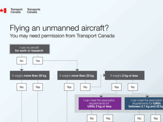
SNRC: UAV Integration Highly Valued in Canadian Marketplace

Due to a foreseeable increase in the demand for UAV acquired aerial imagery in resource management, various firms are already…