• facebook
  • Twitter
  • Linkedin
  • Youtube
  • Linkedin Group
  • Post a Job
  • Post an Ad
  • Post an Event
  • Post a Directory Listing
  • Post a Press Release
  • Media Kit
  • My Account
  • Login
GoGeomatics
  • MAGAZINE
    • BIM & GIS
    • Community
    • Conference news
    • Earth Observation
    • Education & Careers
    • GEOAI
    • Announcements
    • Reality Capture & Lidar
    • Science
    • Technology
    • Between the Poles
  • Directories
    • ASSOCIATION
    • INDUSTRY
    • EDUCATION
    • Open Data
  • EVENTS
    • GeoIgnite Events
    • Events Calendar
    • GoGeomatics Meetups
  • Services
    • Advertising
    • Marketing
    • Post a Job
    • Post an Ad
    • Post an Event
    • Post a Press Release
    • Post a Directory Listing
    • Media Kit
    • Web Design
  • Find a Job
  • Volunteer
    • Start a GoGeomatics Group
    • Editors & Writers Group
  • About Us
    • About Us
    • Contact Us
    • Frequently Asked Questions
  • Videos
HomeGeoIgnite

GeoIgnite

||
Community

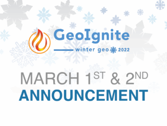
GeoIgnite 2022: March 1 & 2, Canada’s National Geospatial Conference is Back

23 November 2021 GoGeomatics Canada | Canada

GoGeomatics Canada is proud to announce the 4th edition of Canada’s National Geospatial Conference GeoIgnite. Winter Geo is the name of the online event, which will broadcast from Ottawa on March 1st and March 2nd with […]

Community

Canadian Council on Geomatics (CCOG) – Fostering Collaboration Across Canada’s Jurisdictions

18 November 2021 GoGeomatics Canada | Canada

The Canadian Council on Geomatics (CCOG) has been working for over 50 years with the federal government to help with projects and planning in Canada. Learn more about CCOG from Melanie Desjardins, the Chair, in […]

Community

The Canadian Geodetic Survey – Supporting Accurate Geospatial Positioning in Canada

1 November 2021 GoGeomatics Canada | Brian Donahue

NRCan’s Canadian Geodetic Survey is responsible for defining, maintaining, and providing access to the Canadian Spatial Reference System (CSRS). In this talk from the Information Services Manager Brain Donahue on Day Two of GeoIgnite 2021, […]

|||
Technology

NV5 Geospatial Supports Flood Risk Mapping in Montreal Through Canada’s Largest Riverine Topobathymetric Lidar Survey

20 October 2021 Sven Cowan | Canada

The Greater Montréal Area completed Canada’s largest-ever riverine topobathymetric lidar survey inresponse to two major flooding events within the last five years, which together displaced tens ofthousands from their homes and cost millions to local […]

Community

GeoIgnite Talk On YouTube: A closer look at the NV5 Geospatial 2020 aerial topobathymetric lidar survey of Montreal

6 October 2021 GoGeomatics Canada | GeoIgnite

In case you missed it GoGeomatics is highlighting one of the most interesting talks from GeoIgnite from this past April. NV5 Geospatial was granted a special opportunity to carry out one of the largest fluvial […]

Community

Spatial Finance, New Markets For Earth Observation Panel Discussion: Shaking up the EA Marketplace

21 September 2021 GoGeomatics Canada | Bill Greer

This panel, which got a little “Spicy” as one senior Canadian government bureaucrat described it, closed out a great Day Two of GeoIgnite 2021. This panel brought together senior executives and CEOs from some world-renowned geospatial […]

Community

Barbara Ryan – Supporting Decision Makers In Earth Observation & Geospatial: GeoIgnite 2021 Keynote On YouTube:

4 August 2021 GoGeomatics Canada | Barbara J Ryan

Day Three of GeoIgnite began with a fantastic keynote presentation from Barbara Ryan, the WGIC Executive Director. While a lot of panels at GeoIgnite obviously focused on Canada and more national and provincial level geospatial […]

Community

Avenza Quality Cartographic Output For Data With Adobe Illustrator & MAPublisher – GeoIgnite 2021 Talk On YouTube:

23 July 2021 GoGeomatics Canada | adobe illustrator

Adobe Illustrator is not a tool you’d associate with geospatial work, but Avenza is here to show you how to use this software for your cartographic needs! In this talk on Day Three of the […]

Posts pagination

« 1 … 9 10 11 … 19 »

Events

Notice
There are no upcoming events.

View All Events

Services

  • Post a Job
  • Post an Ad
  • Post an Event
  • Post a Directory Listing
  • Post a Press Release
  • Media Kit
  • My Account
  • Login

Jobs

Post a Job
  • Volunteer Editorial Contributor – Be Part of Canada’s Geomatics Story
    Remote
  • Junior Geomatics Field Technician – Technical Surveys
    Montréal, QC
  • GIS Specialist
    Amherst, Nova Scotia
  • Precast Structural BIM Specialist
    Calgary, Alberta
View All Jobs
  • Directories
    • Associations Directory
    • Industry Directory
    • Education Programs
    • Open Data
  • Volunteer
    • Start a GoGeomatics Group
    • Editors & Writers Group
  • About Us
    • GoGeomatics Media Kit
    • Who We Are
    • Contact Us
    • FAQ’s
    • Advertising
    • Marketing
  • Subscribe
GoGeomatics
GoGeomatics is the largest and most popular communications hub promoting the Canadian geospatial community. The business was incorporated in 2011. GoGeomatics hosts over 100 fun, free, location technology networking events each year in cities across Canada.

© 2026 GoGeomatics

  • facebook
  • Twitter
  • Linkedin
  • Youtube
  • Linkedin Group