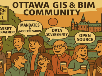
• facebook
  • Twitter
  • Linkedin
  • Youtube
  • Linkedin Group
  • Post a Job
  • Post an Ad
  • Post an Event
  • Post a Directory Listing
  • Post a Press Release
  • Media Kit
  • My Account
  • Login
GoGeomatics
  • MAGAZINE
    • BIM & GIS
    • Community
    • Conference news
    • Earth Observation
    • Education & Careers
    • GEOAI
    • Announcements
    • Reality Capture & Lidar
    • Science
    • Technology
  • Directories
    • ASSOCIATION
    • INDUSTRY
    • EDUCATION
    • Open Data
  • EVENTS
    • GeoIgnite Events
    • Events Calendar
    • GoGeomatics Meetups
  • Services
    • Advertising
    • Marketing
    • Post a Job
    • Post an Ad
    • Post an Event
    • Post a Press Release
    • Post a Directory Listing
    • Media Kit
    • Web Design
  • Find a Job
  • Volunteer
    • Start a GoGeomatics Group
    • Editors & Writers Group
  • About Us
    • About Us
    • Contact Us
    • Frequently Asked Questions
  • Videos
HomeGeospatial data

Geospatial data

Indigenous Lands of Canada dataset
Community

Mapping More Than Land: Why Indigenous Place Names Matter Across Canada

30 July 2025 Kirstyn Howieson | Canada

The first time I traveled to Nunavut, I was told the region I was going to was a hamlet called Kugaaruk. Driving through the town with our local guide, I noticed the radio station was […]

Hexagon Erdas
BIM & GIS

When Every Minute Counts: How Hexagon Tools Speed Up Geospatial Decisions

17 July 2025 Bruce Chaplin | agriculture

Farmers need to know which fields need water today, not next week. When satellite images sit unprocessed, crops suffer, and decisions get delayed. City planners stare at screens filled with infrastructure data, knowing somewhere in […]

Allen Carrol
BIM & GIS

The Mapmaker’s Journey: Allen Carroll on Storytelling, Cartography, and His New Book

12 June 2025 Anusuya Datta | Allen Carroll

On June 10, Allen Carroll’s new book Telling Stories with Maps, was launched, shedding light on the evolving role of maps in storytelling. As the founder of Esri StoryMaps and former Chief Cartographer at National […]

Other

Taking Control of Canada’s Digital Sovereignty with Open-Source GIS

10 June 2025 Anusuya Datta | Canada

(This is the second part of our series, following the article exploring France’s success with open-source GIS) Canada’s geospatial systems are at a crossroads. Technology is moving fast, and the pressure is on for more efficient, […]

Canada wildfire 2025
Earth Observation

Canada is on Fire: Maps, Satellite Data, Smoke Forecasts Powering Emergency Response

2 June 2025 Anusuya Datta | air quality monitoring

Wildfires are raging across Canada — from British Columbia to Nova Scotia — in what is fast becoming another catastrophic fire season. Hot, dry weather and shifting wind patterns are converging to create another intense […]

GEOAI

Aviation & Lidar: Flightpath to innovation

21 May 2025 Alefiya Dungrawala | community

Just as technology continues to evolve at lightning speed, so too does the movement of people across the globe. In today’s hyper-connected world, the skies have become highways, and airports, global crossroads. Air travel remains […]

climate change
Earth Observation

How Geospatial Data Show Us Our Real Environmental Crisis

6 May 2025 Alexander Verbeek | AI

The democratization of geospatial technology means that a farm manager in Costa Rica can check the exact moisture levels of every hectare through a simple phone app like CropX or Climate FieldView, predict pest infestations […]

Bryn Fosburg
Other

Beyond Boundaries: WGIC Horizons 2025 Explores the Future of Geospatial Innovation

29 April 2025 GoGeomatics Canada | AEC

The World Geospatial Industry Council (WGIC) kicked off its annual Horizons 2025 event in Denver with a powerful lineup of thought leaders, industry experts, and innovators all focused on the evolution of geospatial technologies and […]

Posts pagination

« 1 2 3 … 22 »

Events

Notice
There are no upcoming events.

View All Events

Services

  • Post a Job
  • Post an Ad
  • Post an Event
  • Post a Directory Listing
  • Post a Press Release
  • Media Kit
  • My Account
  • Login

Jobs

Post a Job
  • Canada Maps and Poster Gallery Volunteer Leads — GeoIgnite 2026
    remote
  • Software Engineer – Geographic Information System (GIS)
    Ottawa, ON
  • GIS Data Quality Analyst
    Burnaby, British Columbia
  • GIS Cartographer
    Montreal, QC
View All Jobs
  • Directories
    • Associations Directory
    • Industry Directory
    • Education Programs
    • Open Data
  • Volunteer
    • Start a GoGeomatics Group
    • Editors & Writers Group
  • About Us
    • GoGeomatics Media Kit
    • Who We Are
    • Contact Us
    • FAQ’s
    • Advertising
    • Marketing
  • Subscribe
GoGeomatics
GoGeomatics is the largest and most popular communications hub promoting the Canadian geospatial community. The business was incorporated in 2011. GoGeomatics hosts over 100 fun, free, location technology networking events each year in cities across Canada.

© 2025 GoGeomatics

  • facebook
  • Twitter
  • Linkedin
  • Youtube
  • Linkedin Group