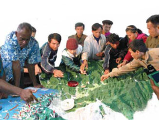
• facebook
  • Twitter
  • Linkedin
  • Youtube
  • Linkedin Group
  • Post a Job
  • Post an Ad
  • Post an Event
  • Post a Directory Listing
  • Post a Press Release
  • Media Kit
  • My Account
  • Shopping Cart
  • Login
GoGeomatics
  • MAGAZINE
    • BIM & GIS
    • Community
    • Conference news
    • Earth Observation
    • Education & Careers
    • GEOAI
    • Announcements
    • Reality Capture & Lidar
    • Science
    • Technology
    • Between the Poles
  • Directories
    • ASSOCIATION
    • INDUSTRY
    • EDUCATION
    • Open Data
  • EVENTS
    • GeoIgnite Events
    • Events Calendar
    • GoGeomatics Meetups
  • Services
    • Advertising
    • Marketing
    • Post a Job
    • Post an Ad
    • Post an Event
    • Post a Press Release
    • Post a Directory Listing
    • Media Kit
    • Web Design
  • Find a Job
  • Volunteer
    • Start a GoGeomatics Group
    • Editors & Writers Group
  • About Us
    • About Us
    • Contact Us
    • Frequently Asked Questions
  • Videos
HomeGeospatial data

Geospatial data

No Picture
Community

NRCan talks to the United Nations about Geomatics

22 January 2014 Jon Murphy | 2013

At the end of last year, I came across what I think is an excellent synopsis of what NRCan and the Canadian Federal Government  are focused on in terms of geomatics.  All of it is […]

VGI Data|The Geo-Wiki Project
Community

VGI: the Wild West of Data and GIS

18 November 2013 Matthew Boyter | 2012

In recent years, high–resolution spaceborne imagery (HRSI), up to 50cm spatial resolution, has become readily available for no cost using such applications as Google Earth and Bing Maps. Thanks to this new availability of free […]

No Picture
Community

GoGeomatics is seeking a Bilingual GIS Data Specialist to work in Africa

10 October 2013 GoGeomatics Canada | africa

GoGeomatics is seeking a bilingual (French/English) GIS Data Specialist to work in Africa on a large scale multicultural project. Responsibilities: Working under the GIS Manager as part of the GIS team, the GIS Data Specialist […]

Community

Geospatial or Geomatics: The Headaches of Terminology in Canada

12 August 2013 Jeff_Thurston | 3D

Great debates about the terms geomatics, geospatial, geoinformation and geoscience have occurred for decades. Additional terms like geoanalysis, geolocation, geocomputation and spatial data infrastructure are mixed into the slurry of ‘geo-ness’. There are even ‘invented’ […]

MacKinnon Carto2013 Open Data Talk
Technology

The Evolution of Canadian Data Collection and Distribution

7 August 2013 T Mackinnon | aerial

One thing I am sure that almost anybody in geomatics would agree with is that major components of any geospatial projects is the data and, like most things in our society, tend to evolve over […]

No Picture
Community

TomTom chooses DMTI Spatial as provider of Canadian location data

6 August 2013 Phil Kaszuba, President, DMTI Spatial | CCA

A lot of planning goes into our summer road trips as we plot our routes, alternate routes and the occasional sight-seeing detour. The age of the passenger seat navigator, lost behind full sheet paper maps […]

GEOINT Canada||Kandahar Airfield Afghanistan Neil Thompson|Neil Thompson with Canadian Military Geo Tech's in the field
Education & Careers

Neil Thompson: Geospatial Intelligence & Canadian Military

23 July 2013 GoGeomatics Canada | 2014

GoGeomatics had the chance to interview Neil Thompson, the Managing partner of the WCGroup. Neil is also the former Director of Geospatial Intelligence for the Canadian Forces and a retired Colonel.  You can have a […]

No Picture
Community

NRCan, GeoConnections, CGDI, & the Canadian Geomatics Round Table

1 April 2013 Jon Murphy | 2012

GoGeomatics Canada got in touch with Natural Resources Canada (NRCan) in order to ask them about all the most recent goings on over there on Booth Street in Ottawa.  Michelle Viau, the Communications Advisor in […]

Posts pagination

« 1 … 19 20 21 22 »

Events

Notice
There are no upcoming events.

View All Events

Services

  • Post a Job
  • Post an Ad
  • Post an Event
  • Post a Directory Listing
  • Post a Press Release
  • Media Kit
  • My Account
  • Shopping Cart
  • Login

Jobs

Post a Job
  • Cartographic Analytical Technician / Technicien, analyses cartographiques; technicienne, analyses cartographiques
    Peterborough
  • Survey Technicians (Field and Office)
    Calgary, Alberta
  • Volunteer Editorial Contributor – Be Part of Canada’s Geomatics Story
    Remote
  • Construction Survey Technician/Technologist
    Britich Columbia
View All Jobs
  • Directories
    • Associations Directory
    • Industry Directory
    • Education Programs
    • Open Data
  • Volunteer
    • Start a GoGeomatics Group
    • Editors & Writers Group
  • About Us
    • GoGeomatics Media Kit
    • Who We Are
    • Contact Us
    • FAQ’s
    • Advertising
    • Marketing
  • Subscribe
GoGeomatics
GoGeomatics is the largest and most popular communications hub promoting the Canadian geospatial community. The business was incorporated in 2011. GoGeomatics hosts over 100 fun, free, location technology networking events each year in cities across Canada.

© 2026 GoGeomatics

  • facebook
  • Twitter
  • Linkedin
  • Youtube
  • Linkedin Group