• facebook
  • Twitter
  • Linkedin
  • Youtube
  • Linkedin Group
  • Post a Job
  • Post an Ad
  • Post an Event
  • Post a Directory Listing
  • Post a Press Release
  • Media Kit
  • My Account
  • Shopping Cart
  • Login
GoGeomatics
  • MAGAZINE
    • BIM & GIS
    • Community
    • Conference news
    • Earth Observation
    • Education & Careers
    • GEOAI
    • Announcements
    • Reality Capture & Lidar
    • Science
    • Technology
    • Between the Poles
  • Directories
    • ASSOCIATION
    • INDUSTRY
    • EDUCATION
    • Open Data
  • EVENTS
    • GeoIgnite Events
    • Events Calendar
    • GoGeomatics Meetups
  • Services
    • Advertising
    • Marketing
    • Post a Job
    • Post an Ad
    • Post an Event
    • Post a Press Release
    • Post a Directory Listing
    • Media Kit
    • Web Design
  • Find a Job
  • Volunteer
    • Start a GoGeomatics Group
    • Editors & Writers Group
  • About Us
    • About Us
    • Contact Us
    • Frequently Asked Questions
  • Videos
HomeGeospatial data

Geospatial data

Technology

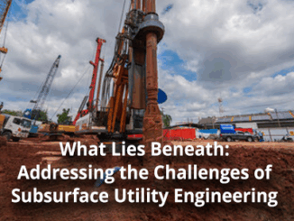
Addressing the Challenges of Subsurface Utility Engineering and Underground Infrastructure

22 October 2024 Anusuya Datta | Advanced Visualization

Subsurface utility engineering (SUE) is a field where precision is critical – missteps can lead to costly delays, safety hazards, and even infrastructure failures. Yet, historically, the underground world has been poorly documented, with incomplete […]

Education & Careers

NAIT Surveying and Geospatial Engineering Technology Students Join the Expo

15 October 2024 Jon Murphy | career paths

Working with the next generation of Canada’s geomatics professionals has always been at the core of what GoGeomatics is all about. The concept of the National Geomatics Expo in Canada has always included collaborating with […]

Technology

Harnessing Earth Observation for Environmental and Industrial Sustainability in Canada

3 October 2024 Anusuya Datta | Canada space Agency

The 2023 State of the Canadian Space Sector Report highlights significant growth in Earth Observation (EO) technologies. In 2022, EO generated $349 million, accounting for 7% of total space sector revenues, marking a 29% increase […]

Technology

Interview: The Crucial Role of Geospatial Data and AI in Building a National Flood Strategy for Canada

10 September 2024 Anusuya Datta | Artificial Intelligence

Canada has faced a surge of extreme weather events in recent years, with devastating floods impacting communities nationwide. These events have highlighted the urgent need for comprehensive flood management and climate adaptation strategies. Joanna Eyquem, […]

Technology

Canadian Geospatial Digest for September 9th, 2024

9 September 2024 Volunteer Editors and Group Writers | BIM

McElhanney Wins 2023 Award of Excellence: A Big Win for Canada’s Geomatics Sector Mapping Montreal’s Bike Paths: GIS on Two Wheels! Toronto’s PATH Map Update: Good Intentions, But Needs Improvement Put Your Geospatial Skills on […]

Community

The Public Good Program is Back at GoGeomatics Expo

15 August 2024 GoGeomatics Expo | ABMI

The Geomatics for the Public Good program at the National Expo highlights how geomatics technology is being harnessed across federal, provincial, and municipal levels to enhance public services and improve citizens’ quality of life. Human […]

Technology

International Geospatial Digest for August 5, 2024

5 August 2024 Volunteer Editors and Group Writers | africa

Geospatial Tech Empowers Governments for Resilience UNOSAT’s project “Strengthening Capacities in the Use of Geospatial Information for Improved Resilience in Asia-Pacific and Africa” aims to equip countries with GIS technology to enhance disaster risk management. […]

Technology

Exploring Geospatial AI: Fighting and Tracking Wildfires

18 July 2024 Jake MacLean | AI

With the rapid growth of AI in recent times it has become clear that its application to many fields will bring added value and capabilities that lead to great leaps and bounds in those respective […]

Posts pagination

« 1 … 5 6 7 … 22 »

Events

Notice
There are no upcoming events.

View All Events

Services

  • Post a Job
  • Post an Ad
  • Post an Event
  • Post a Directory Listing
  • Post a Press Release
  • Media Kit
  • My Account
  • Shopping Cart
  • Login

Jobs

Post a Job
  • Survey Technicians (Field and Office)
    Calgary, Alberta
  • Geospatial Analytical Technician / Technicien, analyses gĂ©ospatiales; technicienne, analyses gĂ©ospatiales
    Peterborough
  • Volunteer Editorial Contributor – Be Part of Canada’s Geomatics Story
    Remote
  • Geomatics Mapping Technician, CAD (GIS)
    British Columbia
View All Jobs
  • Directories
    • Associations Directory
    • Industry Directory
    • Education Programs
    • Open Data
  • Volunteer
    • Start a GoGeomatics Group
    • Editors & Writers Group
  • About Us
    • GoGeomatics Media Kit
    • Who We Are
    • Contact Us
    • FAQ’s
    • Advertising
    • Marketing
  • Subscribe
GoGeomatics
GoGeomatics is the largest and most popular communications hub promoting the Canadian geospatial community. The business was incorporated in 2011. GoGeomatics hosts over 100 fun, free, location technology networking events each year in cities across Canada.

© 2026 GoGeomatics

  • facebook
  • Twitter
  • Linkedin
  • Youtube
  • Linkedin Group