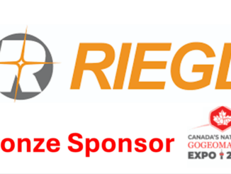
• facebook
  • Twitter
  • Linkedin
  • Youtube
  • Linkedin Group
  • Post a Job
  • Post an Ad
  • Post an Event
  • Post a Directory Listing
  • Post a Press Release
  • Media Kit
  • My Account
  • Login
GoGeomatics
  • MAGAZINE
    • BIM & GIS
    • Community
    • Conference news
    • Earth Observation
    • Education & Careers
    • GEOAI
    • Announcements
    • Reality Capture & Lidar
    • Science
    • Technology
  • Directories
    • ASSOCIATION
    • INDUSTRY
    • EDUCATION
    • Open Data
  • EVENTS
    • GeoIgnite Events
    • Events Calendar
    • GoGeomatics Meetups
  • Services
    • Advertising
    • Marketing
    • Post a Job
    • Post an Ad
    • Post an Event
    • Post a Press Release
    • Post a Directory Listing
    • Media Kit
    • Web Design
  • Find a Job
  • Volunteer
    • Start a GoGeomatics Group
    • Editors & Writers Group
  • About Us
    • About Us
    • Contact Us
    • Frequently Asked Questions
  • Videos
Homegeospatial

geospatial

BIM & GIS

From Smart Maps to Safer Communities: Canada’s New Era of Flood Resilience

27 July 2025 Farzaneh Farshad | AI in Flood Modeling

In June 2025, the Government of Canada announced a $6.8 million investment in 20 new flood-mapping and adaptation projects under the Flood Hazard Identification and Mapping Program (FHIMP). These initiatives promise to revolutionize how we […]

BIM & GIS

How to Bridge Reality and Digital Space – A Conversation with John Hale

27 July 2025 David Legris | #buildingSMARTCanada

Canada’s progress on Building Information Modelling (BIM) standardization and alignment with other spatial technologies has been steadily improving through the work of organization like buildingSMART Canada. Helping to lead this change is John Hale, the […]

Carina
BIM & GIS

Canada’s Surveying Workforce Crisis: SAIT’s Carina Butterworth on Fixing the Pipeline

22 July 2025 Anusuya Datta | BCIT

Canada is entering a once-in-a-generation infrastructure boom — ports, roads, pipelines, renewable energy projects, and national security initiatives are all ramping up under the federal government’s 1.5% GDP commitment to critical infrastructure. But even before […]

Earth Observation

Canada Invests $11.7M in National Wildfire Centre of Excellence to Boost Innovation & Resilience

20 July 2025 GoGeomatics Canada | Canada

With wildfires impacting Canadians across the country, the federal government is taking action to prevent wildfires, mitigate their effects and boost resilience. The Government of Canada’s first priority is protecting Canadians and supporting those affected […]

GEOAI

Federal Government, NWT Launch AI Core Scanning Pilot for Critical Minerals

20 July 2025 GoGeomatics Canada | AI

The Government of Canada and the Government of the Northwest Territories are working together to advance a new geoscience research initiative that leverages artificial intelligence (AI), digital scanning technologies and historic drill cores to unlock […]

Earth Observation

DND Seeks Public Input on Southern Ontario Sites for Arctic Over‑the‑Horizon Radar Program

20 July 2025 GoGeomatics Canada | A-OTHR

The Department of National Defence (DND) is seeking public feedback on the Arctic Over-the-Horizon Radar (A-OTHR) program in southern, Ontario, part of a key NORAD modernization initiative. As part of an announcement published last week, the DND stated that it aims […]

GoGeo
Community

Canada’s Geospatial Moment Is Here — Now Is the Time to Connect With GoGeomatics

18 July 2025 GoGeomatics Canada | Canada

Canada’s Leading Geospatial Media Platform Growing in Canada’s geospatial market takes more than visibility — it takes trust, credibility, and connection. That’s what GoGeomatics delivers. From events and banners to full-service content creation, email campaigns, […]

Hexagon Erdas
BIM & GIS

When Every Minute Counts: How Hexagon Tools Speed Up Geospatial Decisions

17 July 2025 Bruce Chaplin | agriculture

Farmers need to know which fields need water today, not next week. When satellite images sit unprocessed, crops suffer, and decisions get delayed. City planners stare at screens filled with infrastructure data, knowing somewhere in […]

Posts pagination

« 1 … 10 11 12 … 136 »

Events

Notice
There are no upcoming events.

View All Events

Services

  • Post a Job
  • Post an Ad
  • Post an Event
  • Post a Directory Listing
  • Post a Press Release
  • Media Kit
  • My Account
  • Login

Jobs

Post a Job
  • Canada Maps and Poster Gallery Volunteer Leads — GeoIgnite 2026
    remote
  • GIS & Data Analytics Lead
    Beaumont, AB
  • Lead Surveyor, Projects/Arpenteur-géomètre principal, projets; arpenteuse-géomètre principale, projets
    North Bay, Thunder Bay
  • Senior GIS Developer
    Calgary, AB
View All Jobs
  • Directories
    • Associations Directory
    • Industry Directory
    • Education Programs
    • Open Data
  • Volunteer
    • Start a GoGeomatics Group
    • Editors & Writers Group
  • About Us
    • GoGeomatics Media Kit
    • Who We Are
    • Contact Us
    • FAQ’s
    • Advertising
    • Marketing
  • Subscribe
GoGeomatics
GoGeomatics is the largest and most popular communications hub promoting the Canadian geospatial community. The business was incorporated in 2011. GoGeomatics hosts over 100 fun, free, location technology networking events each year in cities across Canada.

© 2025 GoGeomatics

  • facebook
  • Twitter
  • Linkedin
  • Youtube
  • Linkedin Group