Community
EnerGIS 2017 6/5/2017 to 6/6/2017 Suburban Pittsburgh, Pennsylvania. Join us for our 5th annual conference June 5th and 6th 2017! EnerGIS 2017 is an energy-focused Geographic Information Systems conference that brings together GIS professionals and […]
Editors note: This article has been jointly written by Nicolas Gignac, Dami Sonoiki (eHealth Africa) and Samuel Aiyeoribe (eHealth Africa). These authors would like to thank Yves Moisan, Vincent Mora (Oslandia) and Vincent Picavet (Oslandia) for their […]
Note des éditeurs : Cet article a été écrit conjointement par Nicolas Gignac, Dami Sonoiki (eHealth Africa) et Samuel Aiyeoribe (eHealth Africa). Ces auteurs aimeraient remercier Yves Moisan, Vincent Mora (Oslandia) et Vincent Picavet (Oslandia) pour leur support et […]

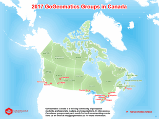
GoGeomatics Canada has built a thriving geospatial community by creating networking opportunities for our participants. We achieve this by holding free informal monthly networking events at pubs across Canada. You can join us at any of these […]
Call for Presentations Following the success of our December event, the URISA BC Executive Team is busy planning our next seminar for the Vancouver Marriott Pinnacle Downtown. Join us in mid-June, 2017 for URISA BC’s […]

GIScience Excellence Award Offered and adjudicated by the GIScience Study Group Annual nominations are due by midnight of 15 April The award will be presented at the Annual Meeting of the GIScience Study Group at […]
The 42nd Annual Conference of the Canadian Cartographic Association “150 Years of Cartography: Past, Present and Future” Location: Carleton University, Ottawa, ON – River Building Date: Wednesday, May 31 – Friday, June 2, 2017 This […]