GITA

Learn about UAVs at the Ottawa June Social

This is the last month for GoGeomatics Socials before we break for the summer, and in Ottawa we’re going out…

Storytelling: Haida Gwaii

Haida Gwaii is a rich source for stories. There are many perspectives and many different formats. In the Haida culture…

SimActive Provides Integrated LiDAR and Photo Solution to Altoa

Montreal, Canada, June 2nd, 2015 – SimActive Inc., a world-leading developer of photogrammetry software, is pleased to announce the purchase…

GANS Mentorship Program Fostering Geospatially-Enabled Society

The Geomatics Association of Nova Scotia (GANS) has been promoting the importance and value of the geomatics sector in Nova…

TECTERRA Funds Additional $4.8 Million for Geomatics Growth in 2014-15

CALGARY, ALBERTA – TECTERRA Inc. announced that it has committed $4.8 million of funds to support the geomatics technology sector…

BlackBridge Networks and Cybera Bring Landsat 8 Imagery to Canadian Academic Institutions and Non-Profits

Lethbridge, Alberta, May 19, 2015  - BlackBridge Networks and Cybera have made a new tool available that gives researchers easy…

Promote Your Geomatics Events & Conferences

The GoGeomatics Canada Event Board is more popular than ever before. There’s no better way to promote your geomatics-related conference,…

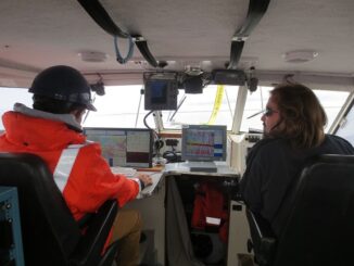
Remote sensing sheds light on Earth’s surface at UVic

The University of Victoria is partnering with the province to develop new ways of using airborne sensors to gather information…

DigitalGlobe Produces the World’s First Complete and Consistent High Resolution Satellite Imagery Base Map of Africa

Apr. 28, 2015– DigitalGlobe, Inc. (NYSE: DGI), a leading global provider of high-resolution earth imagery and geospatial solutions, today announced…

Phase One Industrial and SimActive, Inc. Announce Integrated Software Solution

COPENHAGEN and MONTREAL April 22, 2015 –Phase One Industrial, a leading manufacturer and provider of medium format aerial and industrial…

Brian Kazmerik Honoured with the Roger F. Tomlinson Lifetime Achievement Award

Environmentalist recognized for advancing the use of GIS in conserving Canada’s wetlands WINNIPEG, Esri Canada User Conference – April 21,…

New Point Cloud Capability with SimActive Version 6.1

Montreal, Canada, April 14th, 2015 – SimActive Inc., a world-leading developer of photogrammetry software, is pleased to announce Correlator3D™ version…