• facebook
  • Twitter
  • Linkedin
  • Youtube
  • Linkedin Group
  • Post a Job
  • Post an Ad
  • Post an Event
  • Post a Directory Listing
  • Post a Press Release
  • Media Kit
  • My Account
  • Login
GoGeomatics
  • MAGAZINE
    • BIM & GIS
    • Community
    • Conference news
    • Earth Observation
    • Education & Careers
    • GEOAI
    • Announcements
    • Reality Capture & Lidar
    • Science
    • Technology
  • Directories
    • ASSOCIATION
    • INDUSTRY
    • EDUCATION
    • Open Data
  • EVENTS
    • GeoIgnite Events
    • Events Calendar
    • GoGeomatics Meetups
  • Services
    • Advertising
    • Marketing
    • Post a Job
    • Post an Ad
    • Post an Event
    • Post a Press Release
    • Post a Directory Listing
    • Media Kit
    • Web Design
  • Find a Job
  • Volunteer
    • Start a GoGeomatics Group
    • Editors & Writers Group
  • About Us
    • About Us
    • Contact Us
    • Frequently Asked Questions
  • Videos
HomeGoogle Earth

Google Earth

No Picture
Technology

Evaluation of the Service New Brunswick Geographic Data & Maps Section

18 February 2013 Marcus Hinds | aerial

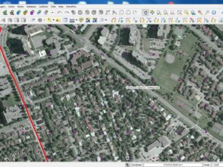
Service New Brunswick  (SNB)  is serving up geospatial data to the community so lets have look at what they are doing.  The portal allows access to all provincial services including, Service New Brunswick locations, employment […]

No Picture
Technology

Projections and Coordinate Systems for GIS: A new perspective on old ideas.

1 February 2013 Zachary Klaas | 3D

Projections and Coordinate Systems for GIS:  A new perspective on old ideas. (Or, GIS Professionals Should Consider That A Lot Of Our Constants Are, Increasingly, Not So Constant.) “I am constant as the northern star, Of […]

No Picture
Community

The Geospatial Desktop: Open Source Tools

9 January 2013 Tyler Mitchell | analysis

Interest in mapping is on the rise, as evidenced by services such as Google Earth, Virtual Earth, MapQuest, and any number of other web mapping mashups. These are all exciting developments, yet there is another […]

No Picture
Technology

Relying on Technology for EMS in Canada – Pros and Cons

8 January 2013 Deanna Sokoloski | 2012

New Years is a time to reminisce about the past year and compile your thoughts. What better way to do so then to reflect on your 140-character opinions. One thought that continually pops into my […]

||
Education & Careers

Lynn Moorman: Finding the Way with Geo-Literacy

19 December 2012 GoGeomatics Canada | 2012

At first glance, navigating the world has never been easier. Getting from Point A to Point B is a snap; just pop an address into your Global Positioning System (GPS) or pull up a map […]

No Picture
Education & Careers

A GIS Postgraduate’s Journal – December 17, 2012

18 December 2012 Deanna Sokoloski | 2012

December 17, 2012 To say that the past semester of school flew by is an understatement. I am still slightly overwhelmed with how much I learnt in such a short amount of time. Since I […]

Happy Clients
Education & Careers

Ethics for the GIS Consultant is Good Business

22 November 2012 Jon Murphy | analysis

I just finished a small GIS job for a client. A really small job. They wanted to know where the Crown lands were in a part of New Brunswick. Not sure what they were going […]

Technology

The Ottawa Tree Canopy Cover Mapping Project

28 September 2012 Regie | 2012

The City of Ottawa Official Plan set a target of 30% tree canopy cover for the entire city. To the author’s knowledge there is no information on the amount of tree canopy for the entire […]

Posts pagination

« 1 … 4 5 6 7 »

Events

Notice
There are no upcoming events.

View All Events

Services

  • Post a Job
  • Post an Ad
  • Post an Event
  • Post a Directory Listing
  • Post a Press Release
  • Media Kit
  • My Account
  • Login

Jobs

Post a Job
  • Canada Maps and Poster Gallery Volunteer Leads — GeoIgnite 2026
    remote
  • GIS & Data Analytics Lead
    Beaumont, AB
  • Lead Surveyor, Projects/Arpenteur-géomètre principal, projets; arpenteuse-géomètre principale, projets
    North Bay, Thunder Bay
  • Senior GIS Developer
    Calgary, AB
View All Jobs
  • Directories
    • Associations Directory
    • Industry Directory
    • Education Programs
    • Open Data
  • Volunteer
    • Start a GoGeomatics Group
    • Editors & Writers Group
  • About Us
    • GoGeomatics Media Kit
    • Who We Are
    • Contact Us
    • FAQ’s
    • Advertising
    • Marketing
  • Subscribe
GoGeomatics
GoGeomatics is the largest and most popular communications hub promoting the Canadian geospatial community. The business was incorporated in 2011. GoGeomatics hosts over 100 fun, free, location technology networking events each year in cities across Canada.

© 2025 GoGeomatics

  • facebook
  • Twitter
  • Linkedin
  • Youtube
  • Linkedin Group