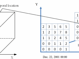
grid

Web Framework for Flood Risk Assessment: Elevation Services and Simplified Flood Models

The development of infrastructure and dense urbanization along water courses and the increasing severity of storm events has brought to…

Elevation Web Services: Limitations and Prospects

Elevation Web Services: Limitations and Prospects Elevation data is necessary for a wide range of geospatial applications such as creating…

Web Mercator: the de facto standard, the controversy, and the opportunity

Four hundred and fifty years ago, the Flemish geographer and cartographer Gerardus Mercator presented the most popular map projection ever.…

PhotoSat verifies accuracy of DigitalGlobe’s 30 cm WorldView-3 satellite elevation data to within 15 cm

VANCOUVER – PhotoSat is pleased to announce that the elevation data processed from DigitalGlobe’s new 30 centimeter resolution satellite, WorldView-3, has…

SPOT Satellite Technology Delivers Peace of Mind for Outdoor Enthusiasts with 1,000 Rescues Initiated in Canada – over 3,500 Rescues Worldwide

Proven and essential safety gear, SPOT devices provide affordable and reliable connectivity, S.O.S. notifications, and real-time GPS tracking, completely independent…

the PYXIS innovation™ Releases the Worldview Software Development Kit

the PYXIS innovation™ team is pleased to announce the release of the WorldView™ Software Development Kit (SDK), the world’s first…

Environmental GIS – City of Toronto Light Pollution Initiative

Nathan Heazlewood, in one of his recent articles, urges us Geomatics practitioners to be proud of the Geospatial profession. GIS…

Expansion of the Inuvik Satellite Station Gets Some Much Needed Fibre Optic Cable

YELLOWKNIFE (July 30, 2014) – The installation of a high-speed fibre optic link connecting communities in the Mackenzie Valley and…

OGC Academic Summit 2014 – Call for Presentations

The Open Geospatial Consortium (OGC) has issued a call for presentations and presentation abstracts at the inaugural OGC Academic Summit…

Lidar / GPS Terrain Modelling for Ice Jam Emergency Response

Prince George BC: Lidar / GPS Terrain Modelling for Ice Jam Emergency Response

Unprecedented ice jams led to extensive flooding in Prince George as temperatures dipped to record lows in the winter of…

LiDAR Reveals Hidden Archaeological Ruins

In April 2012, McElhanney conducted an extensive aerial LiDAR survey in support of archaeological research in Cambodia. It was the…

UAV Mapping

Canadian UAV Company Maps Forest Fire Damage in Alberta

Industry and public awareness for commercial applications of UAV technology has increased significantly in Canada and throughout North America. Initially…