• facebook
  • Twitter
  • Linkedin
  • Youtube
  • Linkedin Group
  • Post a Job
  • Post an Ad
  • Post an Event
  • Post a Directory Listing
  • Post a Press Release
  • Media Kit
  • My Account
  • Login
GoGeomatics
  • MAGAZINE
    • BIM & GIS
    • Community
    • Conference news
    • Earth Observation
    • Education & Careers
    • GEOAI
    • Announcements
    • Reality Capture & Lidar
    • Science
    • Technology
    • Between the Poles
  • Directories
    • ASSOCIATION
    • INDUSTRY
    • EDUCATION
    • Open Data
  • EVENTS
    • GeoIgnite Events
    • Events Calendar
    • GoGeomatics Meetups
  • Services
    • Advertising
    • Marketing
    • Post a Job
    • Post an Ad
    • Post an Event
    • Post a Press Release
    • Post a Directory Listing
    • Media Kit
    • Web Design
  • Find a Job
  • Volunteer
    • Start a GoGeomatics Group
    • Editors & Writers Group
  • About Us
    • About Us
    • Contact Us
    • Frequently Asked Questions
  • Videos
Homeinfrastructure

infrastructure

International Digest April 21||||
Community

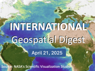
International Geospatial Digest – April 21, 2025

21 April 2025 Volunteer Editors and Group Writers | AI

Meet Biomass, the Satellite Measuring the Carbon Content of Rainforests Google and AI – Geospatial Reasoning Mapping Seagrass Along the Italian Coast with Airborne Lidar Bathymetry Idea to Capture Vanguard-1, a Satellite from 1958 Senegal […]

|PacGeo|Maxar satellite|Maxar satellite|
Earth Observation

Pacific Geomatics Brings Maxar’s WorldView Legion to Canadian Projects

11 April 2025 GoGeomatics Canada | constellation

Pacific Geomatics (PacGeo), a leading Canadian satellite imagery provider, is pleased to announce a limited-time special tasking promotion for Canadian organizations to access high-resolution satellite imagery at an outstanding value. Maxar Intelligence, a longstanding partner […]

Technology

Realistic Expectations for GNSS Infrastructure

28 February 2025 Gavin Schrock | #geomaticvs

The pain of compromise long outlives the sweetness of a low-price. A little field maintenance on this GNSS reference station (on a near-spring-like-day) gave cause for some reflection. Continuously operating reference stations (CORS) can and […]

||||||||
Other

Digital Twins, IoT, and Next-Level Monitoring

17 February 2025 Gavin Schrock | 4D Construction

Leveraging Bentley Systems Digital Twin and IoT Solutions, a Canadian Monitoring Firm Earns an International Infrastructure Award. A next step-up in structural and site monitoring had been a long-time goal for Ontario, Canada-based Monir Precision […]

BIM & GIS

Lidar Innovations and Trends to Look Out For in 2025

20 January 2025 Anusuya Datta | autonomous vehicles

The Lidar (Light Detection and Ranging) market has been experiencing rapid growth, with significant advancements in technology and an expanding range of applications. According to market reports, the global Lidar market size was valued at […]

Conference news

Esri Canada Joins GeoIgnite 2025 as Gold Sponsor

16 January 2025 GoGeomatics Canada | agriculture

Ottawa, ON – GoGeomatics Canada is pleased to announce that Esri Canada has joined GeoIgnite 2025 as a Gold Sponsor. The event will take place May 12-14, 2025, in Ottawa, bringing together industry leaders, government […]

Conference news

XEOS Imaging Joins LidarCANEX 2025 as a Silver Sponsor

3 December 2024 GoGeomatics Canada | 3D Mapping

We’re thrilled to welcome XEOS Imaging, a leader in high-resolution aerial imagery and LiDAR data acquisition, as a Silver Sponsor and Exhibitor at LidarCANEX 2025! Taking place online on January 29-30, 2025, LidarCANEX is Canada’s […]

Technology

Transforming Infrastructure with 3D Digital Twins and AI: Interview with Lukas Fraser of Looq AI

18 November 2024 GoGeomatics Canada | 3D

In this interview with Lukas Fraser, VP of Product at Looq AI, we dive deep into how cutting-edge survey technology is revolutionizing the digitization of critical infrastructure and transforming the way industries approach complex projects. […]

Posts pagination

« 1 … 3 4 5 … 11 »

Events

Notice
There are no upcoming events.

View All Events

Services

  • Post a Job
  • Post an Ad
  • Post an Event
  • Post a Directory Listing
  • Post a Press Release
  • Media Kit
  • My Account
  • Login

Jobs

Post a Job
  • Geospatial Analytical Technician / Technicien, analyses gĂ©ospatiales; technicienne, analyses gĂ©ospatiales
    Peterborough
  • GIS Technologist II
    Fernie, B.C.
  • GIS I TECHNOLOGIST
    Fernie, B.C.
  • Senior Geohazards Specialist
    Ottawa
View All Jobs
  • Directories
    • Associations Directory
    • Industry Directory
    • Education Programs
    • Open Data
  • Volunteer
    • Start a GoGeomatics Group
    • Editors & Writers Group
  • About Us
    • GoGeomatics Media Kit
    • Who We Are
    • Contact Us
    • FAQ’s
    • Advertising
    • Marketing
  • Subscribe
GoGeomatics
GoGeomatics is the largest and most popular communications hub promoting the Canadian geospatial community. The business was incorporated in 2011. GoGeomatics hosts over 100 fun, free, location technology networking events each year in cities across Canada.

© 2026 GoGeomatics

  • facebook
  • Twitter
  • Linkedin
  • Youtube
  • Linkedin Group