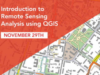
Quickly Learn to use QGIS for Remote Sensing Analysis
Have you wondered how Google is able to create the 3D models? Now you can do it yourself using QGIS. I’m teaching a course that will enable you to process LiDAR and orthophotos and create […]
The College of Geographic Sciences (COGS) held the 2017 COGS Industry Expo on March 23 in Lawrencetown, Nova Scotia. COGS has a long-standing tradition of hosting an annual career fair and inviting industry professionals to […]
At the end of last month, John Wian hosted the Annual General Meeting (AGM) of the CANMAP Research Institute in Bridgetown. The CANMAP Research Institute was formed in the early 1980’s by John, with input […]
What About COGS The Centre of Geographic Sciences (COGS) is one of the best colleges in Canada for learning GIS. As a COGS graduate myself I am writing this article to help future students make […]
Editors note: In this previously published article, Karl Kliparchuk, BCIT GIS Program Head & Instructor uses GIS to explore the aromas and flavors of wine from British Columbia, Canada. We are breaking down BC wine […]
I spent Christmas in Sydney, Cape Breton. While there, I had the time to read David Gauntlett’s book ‘Making is Connecting’. Gauntlett is Professor, Creativity and Design at the University of Westminister, UK. He starts with […]
I had the opportunity to celebrate GIS Day by attending the event hosted by the Alberta Geomatics Group at the Glenbow Museum in downtown Calgary, Alberta. Previous GIS days have been held at the Calgary […]
I have studied Geographic Information Systems (GIS) in both Canada and China. Last summer I completed my master in geography at University of Waterloo. In this article I will draw upon my experiences in China and […]