• facebook
  • Twitter
  • Linkedin
  • Youtube
  • Linkedin Group
  • Post a Job
  • Post an Ad
  • Post an Event
  • Post a Directory Listing
  • Post a Press Release
  • Media Kit
  • My Account
  • Shopping Cart
  • Login
GoGeomatics
  • MAGAZINE
    • BIM & GIS
    • Community
    • Conference news
    • Earth Observation
    • Education & Careers
    • GEOAI
    • Announcements
    • Reality Capture & Lidar
    • Science
    • Technology
    • Between the Poles
  • Directories
    • ASSOCIATION
    • INDUSTRY
    • EDUCATION
    • Open Data
  • EVENTS
    • GeoIgnite Events
    • Events Calendar
    • GoGeomatics Meetups
  • Services
    • Advertising
    • Marketing
    • Post a Job
    • Post an Ad
    • Post an Event
    • Post a Press Release
    • Post a Directory Listing
    • Media Kit
    • Web Design
  • Find a Job
  • Volunteer
    • Start a GoGeomatics Group
    • Editors & Writers Group
  • About Us
    • About Us
    • Contact Us
    • Frequently Asked Questions
  • Videos
HomeMachine Learning

Machine Learning

Bryn Fosburg
Other

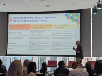
Beyond Boundaries: WGIC Horizons 2025 Explores the Future of Geospatial Innovation

29 April 2025 GoGeomatics Canada | AEC

The World Geospatial Industry Council (WGIC) kicked off its annual Horizons 2025 event in Denver with a powerful lineup of thought leaders, industry experts, and innovators all focused on the evolution of geospatial technologies and […]

BIM & GIS

Lidar Innovations and Trends to Look Out For in 2025

20 January 2025 Anusuya Datta | autonomous vehicles

The Lidar (Light Detection and Ranging) market has been experiencing rapid growth, with significant advancements in technology and an expanding range of applications. According to market reports, the global Lidar market size was valued at […]

BIM & GIS

Geospatial Industry Trends and Developments that Defined 2024

16 December 2024 Anusuya Datta | 3D modeling

The geospatial industry continued to evolve rapidly in 2024, driven by technological advancements and the increasing need for accurate and efficient spatial data. From artificial intelligence (AI) to innovations in reality capture solutions and satellite […]

Technology

Addressing the Challenges of Subsurface Utility Engineering and Underground Infrastructure

22 October 2024 Anusuya Datta | Advanced Visualization

Subsurface utility engineering (SUE) is a field where precision is critical – missteps can lead to costly delays, safety hazards, and even infrastructure failures. Yet, historically, the underground world has been poorly documented, with incomplete […]

Newsmakers & Press Releases

Spatial Data Science certification at Mount Royal University

9 October 2024 GoGeomatics Newsmakers | AI capabilities

Mount Royal University (MRU) now offers post-bachelor’s certificate for Spatial Data Science. A professor from MRU’s Department of Earth and Environmental Sciences underlines the significance of introducing an innovative program that responds to students’ increased […]

Community

The CanSLAM Circuit: Advancing Geomatics Through Innovation and Collaboration

12 September 2024 Alex Hill-Stosky | 3D modeling

What an incredible time to be a mapping professional! Infrastructure the world over continues to change for the better (and worst,) real-world projects are happening everywhere despite our economy being intentionally stagnated, geographic areas continue […]

Technology

Geospatial Advances Using Machine Learning and AI

9 September 2024 Peter Srajer | AI

Artificial Intelligence is complex, but understanding it is relatively simple. -Peter Srager Feed it data, give it a goal, and let it fail and fail until it figures out how to complete the task at […]

Technology

Balancing the AI and Human Elements of Geospatial Applications

9 September 2024 Gavin Schrock | AI

Developers of solutions for geospatial applications have integrated elements of AI for decades. The latest, more powerful (and popularized) wave of AI makes it more difficult to determine an optimal mix. We asked industry thought […]

Posts pagination

« 1 2 3 … 6 »

Events

Notice
There are no upcoming events.

View All Events

Services

  • Post a Job
  • Post an Ad
  • Post an Event
  • Post a Directory Listing
  • Post a Press Release
  • Media Kit
  • My Account
  • Shopping Cart
  • Login

Jobs

Post a Job
  • Asset/GIS Coordinator
    Edson, AB
  • Civic Operations GIS Technologist (Permanent, Full-Time) – 1953
    Kamloops, British Columbia
  • Senior Manager, Data Science – Geospatial
    Mississauga, Ontario
  • AI Manager
    Brampton, Ontario
View All Jobs
  • Directories
    • Associations Directory
    • Industry Directory
    • Education Programs
    • Open Data
  • Volunteer
    • Start a GoGeomatics Group
    • Editors & Writers Group
  • About Us
    • GoGeomatics Media Kit
    • Who We Are
    • Contact Us
    • FAQ’s
    • Advertising
    • Marketing
  • Subscribe
GoGeomatics
GoGeomatics is the largest and most popular communications hub promoting the Canadian geospatial community. The business was incorporated in 2011. GoGeomatics hosts over 100 fun, free, location technology networking events each year in cities across Canada.

© 2026 GoGeomatics

  • facebook
  • Twitter
  • Linkedin
  • Youtube
  • Linkedin Group