• facebook
  • Twitter
  • Linkedin
  • Youtube
  • Linkedin Group
  • Post a Job
  • Post an Ad
  • Post an Event
  • Post a Directory Listing
  • Post a Press Release
  • Media Kit
  • My Account
  • Login
GoGeomatics
  • MAGAZINE
    • BIM & GIS
    • Community
    • Conference news
    • Earth Observation
    • Education & Careers
    • GEOAI
    • Announcements
    • Reality Capture & Lidar
    • Science
    • Technology
    • Between the Poles
  • Directories
    • ASSOCIATION
    • INDUSTRY
    • EDUCATION
    • Open Data
  • EVENTS
    • GeoIgnite Events
    • Events Calendar
    • GoGeomatics Meetups
  • Services
    • Advertising
    • Marketing
    • Post a Job
    • Post an Ad
    • Post an Event
    • Post a Press Release
    • Post a Directory Listing
    • Media Kit
    • Web Design
  • Find a Job
  • Volunteer
    • Start a GoGeomatics Group
    • Editors & Writers Group
  • About Us
    • About Us
    • Contact Us
    • Frequently Asked Questions
  • Videos
Homemapping

mapping

No Picture
Education & Careers

Fall Reading in Canada: landscape, language, geography

29 September 2016 Robert Maher | 2016

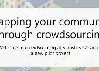
Last week, I picked up a copy of Robert MacFarlane’s ‘Landmarks’. I had read all of his previous works and seen reviews of ‘Landmarks’ online from the UK. MacFarlane’s book got me thinking about community […]

Community

Volunteer & Map Canada: Statistics Canada Crowdsourcing Pilot Project

22 September 2016 Jon Murphy | 2016

Statistics Canada has launched a new pilot project using OpenStreetmap.  For  many Canadians outside of the geomatics community this is an exiting opportunity.  It’s my hope that those members of the public who do volunteer […]

Newsmakers & Press Releases

Conference: Where Geomatics Meets GeoScience

13 September 2016 GoGeomatics Newsmakers | 2016

With now only one month to go until the 2nd Virtual Geoscience Conference (VGC 2016) takes place in Bergen, Norway, updated details of the event and programme have been released. VGC 2016 is a forum […]

|||||
Technology

How Canadian Remote Sensing Was Made Commercially Successful & Exportable

7 September 2016 Robert Ryerson | activity

This piece started as a note on some of my experience as an international consultant in remote sensing specifically and geomatics more generally. But as I looked more and more at the role of consulting, […]

|
Technology

LiDAR in Canada: Conversation with Dr. Chris Hopkinson Research Chair Remote Sensing University of Lethbridge

6 September 2016 Robert Maher | 3D

The author Bob Maher (BM) and Chris Hopkinson (CH) both worked as scientists at the Appied Geomatics Reearch Group (AGRG) between 2004-2011. Five years later, it was time to catch up. Chris is currently Research […]

No Picture
Community

GIS Health Studies: Conduct Spatial Exposure Assessments

5 September 2016 Anders Erickson | 2016

Interested in how to conduct different types of spatial exposure assessments for air pollution or other exposures to a population?  PHDA04: Spatial Epidemiology and Outbreak Detection is a great place to start. Exposure assessment is the […]

Newsmakers & Press Releases

CIG Advancements in Geomatics 2016 Conference in New Brunswick Sept 26th-28th

31 August 2016 GoGeomatics Newsmakers | 2016

Advancements in Geomatics – Research and Collaboration for Informed Decisions in a Changing World The Canadian Institute of Geomatics (CIG) New Brunswick Branch and the Conference Organizing Committees, invite you to join us as a […]

No Picture
Newsmakers & Press Releases

Airobotics Selects SimActive’s Photogrammetry Software for its Automated Industrial Drone Solution

30 August 2016 GoGeomatics Newsmakers | 2016

Montreal, Canada, August 30th, 2016 – SimActive Inc., a world-leading developer of photogrammetry software, is pleased to announce that Airobotics has chosen Correlator3D™ for its drone platforms. The software will be used to derive mapping […]

Posts pagination

« 1 … 41 42 43 … 79 »

Events

Notice
There are no upcoming events.

View All Events

Services

  • Post a Job
  • Post an Ad
  • Post an Event
  • Post a Directory Listing
  • Post a Press Release
  • Media Kit
  • My Account
  • Login

Jobs

Post a Job
  • GIS Technologist II
    Fernie, B.C.
  • GIS I TECHNOLOGIST
    Fernie, B.C.
  • Operations Spatial Data Assistant (Contract)
    Vaughan
  • GIS Analyst
    Saint John, New Brunswick
View All Jobs
  • Directories
    • Associations Directory
    • Industry Directory
    • Education Programs
    • Open Data
  • Volunteer
    • Start a GoGeomatics Group
    • Editors & Writers Group
  • About Us
    • GoGeomatics Media Kit
    • Who We Are
    • Contact Us
    • FAQ’s
    • Advertising
    • Marketing
  • Subscribe
GoGeomatics
GoGeomatics is the largest and most popular communications hub promoting the Canadian geospatial community. The business was incorporated in 2011. GoGeomatics hosts over 100 fun, free, location technology networking events each year in cities across Canada.

© 2026 GoGeomatics

  • facebook
  • Twitter
  • Linkedin
  • Youtube
  • Linkedin Group