mars
International Geospatial Digest February 13th, 2023
Esri Signs Space Act Agreement with NASA Earthquakes in Turkey and Syria Stitching together health data and GIS for better…
Canadian Geospatial Briefing Sept 20th: Interactive Election Map; MDA awarded with contract for Martian Moons Exploration with Japan Aerospace Exploration Agency; Geomatics Instructor at BCIT uses Drone to Display Elevation Changes at Construction Site; Looking at Foot Traffic in the Downtown Core of Major Canadian Cities Compared to Pre-Pandemic Levels; Apple Maps using Special Backpacks to Gather Data for Look Around Feature
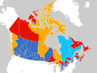
Interactive: How Canadians voted in the past 7 federal elections With the federal elections coming up on September 20th, Esri…
Your Canadian Geospatial Briefing for Sept 22: First woman to head CSA; Polar Bears’ GPS Collars Reveal Hidden Histories; Data Crisis in Covid-19; What Would The Impact of the Beirut Explosion Look Like on Maps of Canadian Cities; Should You Get a GIS Certification?
Lisa Campbell becomes the first woman to head the Canadian Space Agency – CBC The Government of Canada announced earlier…
Toronto & Calgary: Federal Floodplain Mapping Workshop March 28th & 30th
The Federal Floodplain Mapping Guidelines workshop, hosted by Canadian Water Resources Association (CWRA) on behalf of the Government of Canada,…
Top Ten Climate Change Maps and GIS Applications
Awareness for climate change has been steadily increasing ever since the Green Revolution in the 1960s. There is a plethora…
DigitalGlobe’s Basemap Suite Expands: 250 Million Square Kilometers of 30 cm Imagery
DigitalGlobe, Inc. (NYSE: DGI), the global leader in Earth imagery and information about our changing planet, today announced that its…
Georeferencing Scanned Maps Using QGIS
One of the passions of modern day information technologists is to convert the past to digital form and to put…
Presagis Showcases New Modeling and Simulation Software Suite at I/ITSEC 2015
Unmanned Aerial Systems Border Surveillance demo reveals the realism, power and versatility of Presagis’ M&S Suite 15 MONTREAL, CANADA–(Marketwired –…
BlackBridge to be Acquired by Planet Labs
BlackBridge, a leading provider of satellite imagery and geospatial solutions, announced today that it has entered into a definitive agreement…
Ed Kennedy Discuses GIAC’s Past and Future
The Canadian geomatics community has been discussing and debating the importance of having a thriving and useful geomatics industry association. …
January 1, 2014 Canadian GoGeomatics MERX Report
Here is the January 1st, 2014 GoGeomatics MERX Report. Login to see the contracts on MERX Geomatics Services Published: …
Surveying in Action – Occam’s razor at Gull River Indian Reserve: The south boundary
By Dr. Brian Ballantyne Surveyor General Branch, NRCan Reprinted from the Ontario Professional Surveyor, Volume 56, No. 4, Fall 2013…