Top 5 Popular GoGeomatics Articles from 2015
It’s that time again! Time to take a look back at the last year on the Magazine and see which articles were the most popular with our readers. We had a lot of great reads […]

It’s that time again! Time to take a look back at the last year on the Magazine and see which articles were the most popular with our readers. We had a lot of great reads […]

With popular holiday gift comes great responsibility OTTAWA, Dec. 11, 2015 /CNW/ – Drones, also known as unmanned air vehicles, are sure to be a popular gift this holiday season. With ownership comes great responsibility, […]

A Federal Aviation Administration task force has recommended requiring owners of all drones larger than 9 oz. (250 grams) to register with the government, a move that could affect hundreds of thousands of US drone […]

This week Turkish F-16s took out a Russian military jet along the Turkish-Syrian border. Turkey is a NATO member and any conflict with Russia could immediately trigger the collective defense clauses of all NATO members. […]

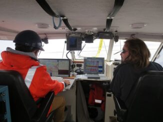
This article was reprinted with permission from the Ontario Professional Surveyor, Volume 56, No. 3, Summer 2015 By Theresa Nicholsi, Scott Youngblutii, Jonathan Mooreiii and Ryan Harrisiii. The 2014 discovery of HMS Erebus, one of […]

This article focuses on the process of creating a very out-of-date map in GIS. Lots has gone on since I posted Gettysburg: What Could Lee See? last summer. Technology continues to evolve at a dizzying […]

Mr. Dirk Werle, Partner / Geoscientist, Ærde Environmental Research, Halifax Date: Friday, November 13, 2015 Time: 10:30 – 12:00 Location: Room O-23, 560 Rochester Street Speaking on: Setting the Sights on the Cities: The Halifax […]

The French company PlanetObserver, specialized in imagery base map production for more than 25 years, announced the coverage of more than 50 Mill. sq km with PlanetSAT 15 L8 base map. Processed from Landsat 8 […]