multispectral

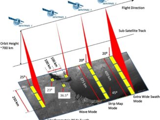
Free Satellite Imagery For You: Sentinel 1 & 2

Sentinel constellations and data products As the ENVISAT program is coming to an end, the European Space Agency has begun…

Teledyne Optech introduces low-cost, automated airborne surveying at GEOINT 2016

Teledyne Optech is pleased to announce that it will showcase its latest airborne systems including the autonomous Optech Eclipse at…

SNRC: UAV Integration Highly Valued in Canadian Marketplace

Due to a foreseeable increase in the demand for UAV acquired aerial imagery in resource management, various firms are already…

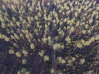
UAV Technology in the Canadian Forestry Sector

The Unmanned Aerial Vehicle (UAV) industry is soaring! Civilian drones are being applied in various global industries ranging from agriculture…

Innovative solutions for bathymetry at Oceanology International 2016

March 7, 2016 — Teledyne Optech is pleased to announce that it is taking its most powerful and flexible surveying…

Optech Titan wins Grand Award and Award for Technology Innovation at MAPPS 2016

February 9, 2016 — Teledyne Optech is pleased to announce that its Optech Titan multispectral airborne lidar has won both…

New results from Optech Titan field tests

New results from Optech Titan field tests at AGU Fall Meeting December 8, 2015 — Teledyne Optech is pleased to…

Teledyne Optech a sponsor at 2015 Asian Conference on Remote Sensing

October 14, 2015 — Teledyne Optech is pleased to announce we are a sponsor at the Asian Conference on Remote…

Montreal: AeroVironment Chooses SimActive’s Correlator3D™

Montreal, Canada, September 22nd, 2015 – SimActive Inc., a world-leading developer of photogrammetry software, is pleased to announce that AeroVironment…

UrtheCast Releases World’s First Full-Color HD Videos Of Earth From Space

Videos of London, Boston, and Barcelona showcase life on Earth viewed from the International Space Station. VANCOUVER, June 17, 2015…

UAV Manufacturer Draganfly Innovations Inc. Offers Agricultural Remote Sensing Solutions

Draganfly Innovations Inc. releases an advanced precision agriculture solution that redefines the way agricultural data is collected and viewed. The…

St-Isidore, Ontario: ING Robotic Aerial Mapping / Precision Agriculture

ING Robotic Aviation is partnering with ASG Mapping to rigorously assess and develop the application of small robotic aircraft systems…