north atlantic right whales

Canadian Geospatial Briefing November 7th, 2022

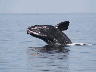
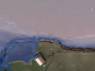
Regina’s crime map Coastal flooding can be predicted in advance using the NSCC’s online map. New satellite imagery encourages the…

Geomatics Tools In The Protection and Conservation of North American Right Whales

Right Whale Biology + Conservation When speaking about declining populations in species, the words endangered, vulnerable and threatened often come…

Canadian Geospatial Briefing for November 9th: McMaster historical map conservation; Underwater acoustic gliders for whale detection; New satellites to track space debris; Microsoft Azure powers regenerative agriculture; Multi-parties’ drone research; Driverless shuttles take road tests

Newly conserved rare map provides unique snapshot of life in 19th century Ontario https://brighterworld.mcmaster.ca/articles/newly-conserved-rare-map-provides-vivid-snapshot-of-life-in-19th-century-ontario/ McMaster University Library’s Preservation Lab conservators…