• facebook
  • Twitter
  • Linkedin
  • Youtube
  • Linkedin Group
  • Post a Job
  • Post an Ad
  • Post an Event
  • Post a Directory Listing
  • Post a Press Release
  • Media Kit
  • My Account
  • Login
GoGeomatics
  • MAGAZINE
    • BIM & GIS
    • Community
    • Conference news
    • Earth Observation
    • Education & Careers
    • GEOAI
    • Announcements
    • Reality Capture & Lidar
    • Science
    • Technology
  • Directories
    • ASSOCIATION
    • INDUSTRY
    • EDUCATION
    • Open Data
  • EVENTS
    • GeoIgnite Events
    • Events Calendar
    • GoGeomatics Meetups
  • Services
    • Advertising
    • Marketing
    • Post a Job
    • Post an Ad
    • Post an Event
    • Post a Press Release
    • Post a Directory Listing
    • Media Kit
    • Web Design
  • Find a Job
  • Volunteer
    • Start a GoGeomatics Group
    • Editors & Writers Group
  • About Us
    • About Us
    • Contact Us
    • Frequently Asked Questions
  • Videos
HomeOpenStreetmap

OpenStreetmap

No Picture
Community

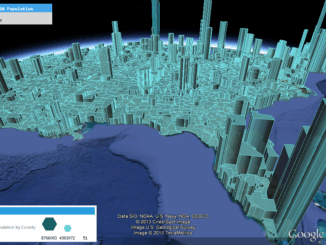
Map Tiles and Cached Map Services

6 December 2015 Emmanuel Stefanakis | 2015

  The tiling of large maps is an old practice. Large paper maps have always been divided into a series of map sheets at various scales. With the increasing popularity of web mapping applications and […]

No Picture
Community

GIS: Adventures in Historical Mapping

2 November 2015 Bert V. de Bruijn | advancement

This article focuses on the process of creating a very out-of-date map in GIS. Lots has gone on since I posted Gettysburg: What Could Lee See? last summer. Technology continues to evolve at a dizzying […]

No Picture
Technology

Elevation Web Services: Limitations and Prospects

2 November 2015 Emmanuel Stefanakis | 2014

Elevation Web Services: Limitations and Prospects Elevation data is necessary for a wide range of geospatial applications such as creating relief maps and rendering 3D visualizations, deriving the slope and aspect of a geographic area, […]

No Picture
Technology

Web Mercator: the de facto standard, the controversy, and the opportunity

23 September 2015 Emmanuel Stefanakis | 2014

Four hundred and fifty years ago, the Flemish geographer and cartographer Gerardus Mercator presented the most popular map projection ever. It became fairly the standard projection for nautical maps because of its ability to represent […]

|
Community

5 Signs You Have an OSM Addiction

15 July 2015 GoGeomatics Canada | City

As those of you who have tried their hand at OpenStreetMapping know, OSM can quickly turn from a hobby into a full-blown obsession! OpenStreetMap is a free, editable, open access map created by volunteers all […]

|
Community

Speaker Series: Local Mapping at Ottawa May Social

28 April 2015 GoGeomatics Canada | 2013

The Ottawa May GoGeomatics Social is happening Friday, May 29, 7:00PM in the basement of the James Street Pub. This month we’re excited to welcome guest speaker Richard Burcher, who will be telling the group […]

No Picture
Newsmakers & Press Releases

Visualize Business Data More Easily – Release of NACMAP Version 5.0

21 October 2014 GoGeomatics Newsmakers | 2014

NAC Geographic Products Inc.  announced the release of NACMMAP Version 5.0 – a standalone NAC enhanced business data mapping and real time assets tracking software. The NAC enhanced mapping software can read data directly from online database servers, […]

||||||||||
Technology

Designing with Information: GIS with Dimension, Ease of Use & Visually Unique

15 July 2013 Edgar Baculi | accuracy

Geomatics and other industries which desire data in accurate yet visually stimulating presentations of communication and information are frequently turning heads at the evolving use of infographics. This inquiry of data and technology fused with […]

Posts pagination

« 1 … 3 4 5 »

Events

Notice
There are no upcoming events.

View All Events

Services

  • Post a Job
  • Post an Ad
  • Post an Event
  • Post a Directory Listing
  • Post a Press Release
  • Media Kit
  • My Account
  • Login

Jobs

Post a Job
  • Canada Maps and Poster Gallery Volunteer Leads — GeoIgnite 2026
    remote
  • GIS & Data Analytics Lead
    Beaumont, AB
  • Lead Surveyor, Projects/Arpenteur-géomètre principal, projets; arpenteuse-géomètre principale, projets
    North Bay, Thunder Bay
  • Senior GIS Developer
    Calgary, AB
View All Jobs
  • Directories
    • Associations Directory
    • Industry Directory
    • Education Programs
    • Open Data
  • Volunteer
    • Start a GoGeomatics Group
    • Editors & Writers Group
  • About Us
    • GoGeomatics Media Kit
    • Who We Are
    • Contact Us
    • FAQ’s
    • Advertising
    • Marketing
  • Subscribe
GoGeomatics
GoGeomatics is the largest and most popular communications hub promoting the Canadian geospatial community. The business was incorporated in 2011. GoGeomatics hosts over 100 fun, free, location technology networking events each year in cities across Canada.

© 2025 GoGeomatics

  • facebook
  • Twitter
  • Linkedin
  • Youtube
  • Linkedin Group