Place
My COGS GIS Education, Part II
In my first article, I introduced the how and why I chose to attend COGS from the fall of 2014…
Outil de versionnement des données géographiques à code source ouvert pour des environnements multi-contributeurs (partie 2)
This article is also available in English. Cet article est la 2e partie de l’outil de versionnement des données géographiques à code…
Outil de versionnement des données géographiques à code source ouvert pour des environnements multi-contributeurs (partie 1)
Note des éditeurs : Cet article a été écrit conjointement par Nicolas Gignac, Dami Sonoiki (eHealth Africa) et Samuel Aiyeoribe (eHealth Africa). Ces auteurs…
CCA Ottawa Conference: “150 Years of Cartography: Past, Present and Future”
The 42nd Annual Conference of the Canadian Cartographic Association “150 Years of Cartography: Past, Present and Future” Location: Carleton University,…
Free Webinar March 15th: NRCan, OGC, & USGS Arctic Spatial Data Pilot Demonstration
The Canada Centre for Mapping and Earth Observation invites you to attend the Arctic Spatial Data Pilot Demonstration Webinar. Managed and…
Top Ten Climate Change Maps and GIS Applications
Awareness for climate change has been steadily increasing ever since the Green Revolution in the 1960s. There is a plethora…
CIG – Newfoundland and Labrador: Free Lunch and Geomatics Lecture March 2nd
The Canadian Institute of Geomatics, Newfoundland Branch, is delighted to host a FREE luncheon on Thursday, March 2, 2017, at…
Interview with Sam Scovill, GIS Technician and 3 Day Champion on Jeopardy
Every weeknight, my mom and I watch Jeopardy together. Jeopardy always starts with the announcement of the contestants by their…
Geospatial Career Night: Toronto GoGeomatics February 16
Thursday, February 16, 2017 – 7:00 PM Betty’s On King (Upstairs) 240 King St East , Toronto, ON Join GoGeomatics…
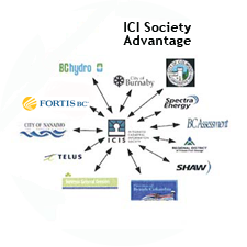
The Integrated Cadastral Information (ICI) Society and ParcelMap BC
This is the first of two articles on the release of ParcelMap BC Data, which we see as a significant…
Upgrade your Geospatial Skills: leveraging the power of MOOCs
What I want to share with you are some resources related to something called Massive Open Online Course (MOOC) where…
Marine Geomatics Primer: Using UUVs to Take Flight Underwater
Unmanned Underwater Vehicles One of the most interesting things to happen in regards to marine geomatics technology has been the…


