procedures

UAV Surveys – How to Ensure Accuracy and Precision

For the past four years, I’ve been involved with the capture and delivery of data derived from drones. My experience…

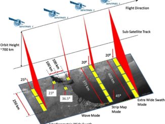
Free Satellite Imagery For You: Sentinel 1 & 2

Sentinel constellations and data products As the ENVISAT program is coming to an end, the European Space Agency has begun…

My COGS GIS Education, Part II

In my first article, I introduced the how and why I chose to attend COGS from the fall of 2014…

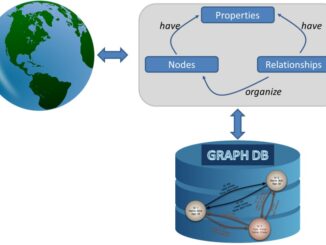
Graph Databases – Recent development in Neo4j may help accommodate the Geospatial Community

Graph Databases and GIS & Technology (GIS&T) In the era of big data, graph databases are becoming very popular as…

The Future of GIS Software? QGIS A Popular Open-Source GIS for the Masses

In today’s geomatics society, ArcGIS, developed by Esri, is a giant and dominates the GIS software market. However, there are…

How to Start Your Career in GIS

You are reaching the point of your life where you are finishing up your last year of college or university…

UAVs in Canada – Key Exposures to Loss and Ways to Protect Yourself

This article was written by Mark Sampson for the Association of Ontario Land Surveyors. Mark’s contact details are at the…

DisasterLAN Successfully Implemented by Alberta’s Emergency Management Agency

After a competitive RFP process, the Alberta Emergency Management Agency (AEMA) has chosen Buffalo Computer Graphics’ (BCG) DisasterLAN (DLAN) as…

UNB Prof. Emmanuel Stefanakis Authors Book on GIS

A new textbook on geographic information systems by GGE’s Professor Emmanuel Stefanakis has just been published by CreateSpace. Entitled Geographic…

New CSA Group Standard Addressing Snow Load Risks on Infrastructure in Canada’s Far North Now Available for Online Public Review

TORONTO, ONTARIO- – CSA Group, a leading provider of standards development services, today announces that the third of four new…

Western Canada Marine Response Corporation Receives Award of Excellence for Integrating GIS into Its Emergency Response Planning

VICTORIA, Esri Canada User Conference –Western Canada Marine Response Corporation (WCMRC) was presented with an Award of Excellence by Esri…

Geospatial jobs

How to Ace your next GIS Job interview

GoGeomatics Canada holds career seminars ever so often that are popular for their industry-specific tips and incites. The last time…