Newsmakers & Press Releases
Devastating California Wildfires: SAR images from the Copernicus Sentinel-1
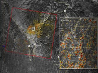
› Larger view As firefighters continue to battle the destructive Camp Fire in Northern California, the Advanced Rapid Imaging and Analysis (ARIA) team at NASA’s Jet Propulsion Laboratory in Pasadena, California, has produced a new […]