Education & Careers
Getting to First Base with GIS
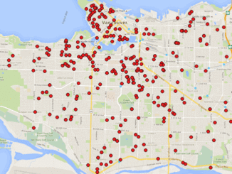
A friend of mine who volunteers with a girls’ softball team came to me with a request recently. “I have the addresses of all of the girls in our softball league”, she said. “I want […]
A friend of mine who volunteers with a girls’ softball team came to me with a request recently. “I have the addresses of all of the girls in our softball league”, she said. “I want […]

Elevation Web Services: Limitations and Prospects Elevation data is necessary for a wide range of geospatial applications such as creating relief maps and rendering 3D visualizations, deriving the slope and aspect of a geographic area, […]
For over fifty years, the islands off the coast of British Columbia and Alaska have been called ‘the outer shores’. This goes back to the pioneering exploration by Ed Ricketts, an ecologist, who gained renown […]
An exciting new online publication, Drone Coalition, launched in conjunction with the InterDrone 2015 Conference and Exposition in Las Vegas, with the goal of bringing extensive information and current trends into the spotlight. “Drones” or […]
In February 2005, Google Maps was launched as a desktop web mapping service. A few months later, in June 2005, Google Earth was released for personal computers. Since then, people around the globe have been […]
It is with great pleasure that I want to introduce a new Web Mapping and Geospatial textbook to the Canadian geomatics community. Prof. Emmanuel Stefanakis (University of New Brunswick, Canada) has authored an introductory textbook on […]

In the world of Remote Sensing, one of the key concepts is ground truthing. This has both a positional component, as well as a field verification of the land cover. These complementary activities are important […]
Richmond, BC – MacDonald, Dettwiler and Associates Ltd. (“MDA” or the “Company”) (TSX: MDA), a global communications and information company, announced that it has been awarded three contracts with the Malaysian Remote Sensing Agency (MRSA), […]