• facebook
  • Twitter
  • Linkedin
  • Youtube
  • Linkedin Group
  • Post a Job
  • Post an Ad
  • Post an Event
  • Post a Directory Listing
  • Post a Press Release
  • Media Kit
  • My Account
  • Shopping Cart
  • Login
GoGeomatics
  • MAGAZINE
    • BIM & GIS
    • Community
    • Conference news
    • Earth Observation
    • Education & Careers
    • GEOAI
    • Announcements
    • Reality Capture & Lidar
    • Science
    • Technology
    • Between the Poles
  • Directories
    • ASSOCIATION
    • INDUSTRY
    • EDUCATION
    • Open Data
  • EVENTS
    • GeoIgnite Events
    • Events Calendar
    • GoGeomatics Meetups
  • Services
    • Advertising
    • Marketing
    • Post a Job
    • Post an Ad
    • Post an Event
    • Post a Press Release
    • Post a Directory Listing
    • Media Kit
    • Web Design
  • Find a Job
  • Volunteer
    • Start a GoGeomatics Group
    • Editors & Writers Group
  • About Us
    • About Us
    • Contact Us
    • Frequently Asked Questions
  • Videos
HomeSatellite imagery

Satellite imagery

Community

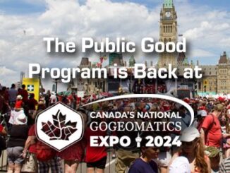
The Public Good Program is Back at GoGeomatics Expo

15 August 2024 GoGeomatics Expo | ABMI

The Geomatics for the Public Good program at the National Expo highlights how geomatics technology is being harnessed across federal, provincial, and municipal levels to enhance public services and improve citizens’ quality of life. Human […]

Technology

Exploring Geospatial AI: Fighting and Tracking Wildfires

18 July 2024 Jake MacLean | AI

With the rapid growth of AI in recent times it has become clear that its application to many fields will bring added value and capabilities that lead to great leaps and bounds in those respective […]

Technology

As Wildfires Rage, Canada Bolsters Wildfire Intelligence with Tech Advancements

6 June 2024 Anusuya Datta | Canadian Space Agency

As Canada heads into another wildfire season, the Canadian Safety and Security Program (CSSP) has announced a call for proposals to advance wildfire detection and suppression through innovative science and technology solutions. A key goal […]

Technology

Exploring Geospatial AI: Understanding and Preventing Deforestation

9 April 2024 Jake MacLean | AI

Global forests are one of our most important resources, not only for the service they provide as the lungs of the earth but also as a renewable and reliable resource for many people in industrial […]

Technology

Exploring Geospatial AI: Icebergs and Advanced Weather Forecasting

2 April 2024 Jake MacLean | AI

AI is everywhere. ChatGPT made headlines with its initial release in November 2022, and just over a year later here we are, with interest in AI growing exponentially. Some other popular AI iterations we have […]

Technology

Canadian Geospatial Digest for February 12th, 2024

12 February 2024 Volunteer Editors and Group Writers | climate action

Laurier Professor Charts Northern Ice Roads A Laurier professor pioneers the mapping of northern ice roads, crucial lifelines in remote Canadian regions. Utilizing geospatial technology and satellite imagery, the project aims to improve the accuracy […]

Technology

NRCan Dives into the Era of GeoAI-generated Spatial Data

5 February 2024 Alefiya Dungrawala | Canadian Centre for Mapping and Earth Observation(CCMEO)

What is GeoAI?  GeoAI is an abbreviation for Geographic Information Systems and Artificial Intelligence, representing a powerful amalgamation of spatial data, smart algorithms, and automation. The continual growth of satellite technology helps to generate high-resolution, […]

Technology

Canadian Geospatial Digest October 16, 2023

16 October 2023 Volunteer Editors and Group Writers | Artificial intelligence (AI)

New BC LiDAR Program Enhances Climate Resiliency and Land-Use Planning Satellite Photos Capture BC Wildfires AI in the Forestry Sector: Kelowna Startup’s Innovation Period Pin Maps Free Menstrual Hygiene Products in Guelph New Autonomous Drone […]

Posts pagination

« 1 … 5 6 7 … 16 »

Events

Notice
There are no upcoming events.

View All Events

Services

  • Post a Job
  • Post an Ad
  • Post an Event
  • Post a Directory Listing
  • Post a Press Release
  • Media Kit
  • My Account
  • Shopping Cart
  • Login

Jobs

Post a Job
  • Geospatial Analytical Technician / Technicien, analyses gĂ©ospatiales; technicienne, analyses gĂ©ospatiales
    Peterborough
  • GIS Technologist II
    Fernie, B.C.
  • GIS I TECHNOLOGIST
    Fernie, B.C.
  • Hydrogeologist
    Calgary, Alberta
View All Jobs
  • Directories
    • Associations Directory
    • Industry Directory
    • Education Programs
    • Open Data
  • Volunteer
    • Start a GoGeomatics Group
    • Editors & Writers Group
  • About Us
    • GoGeomatics Media Kit
    • Who We Are
    • Contact Us
    • FAQ’s
    • Advertising
    • Marketing
  • Subscribe
GoGeomatics
GoGeomatics is the largest and most popular communications hub promoting the Canadian geospatial community. The business was incorporated in 2011. GoGeomatics hosts over 100 fun, free, location technology networking events each year in cities across Canada.

© 2026 GoGeomatics

  • facebook
  • Twitter
  • Linkedin
  • Youtube
  • Linkedin Group