Technology
Your International Geospatial Briefing for January 11th : EA images major 2020 events; Maps are the future of smart cities & AV; Airbus-built CSO-2 French military Earth Observation satellite launched successfully; 2021 predictions for the drone industry; Indian Armed Forces ‘Reject’ Defense Ministry’s plan to ease norms On Geospatial Mapping.
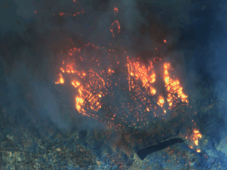
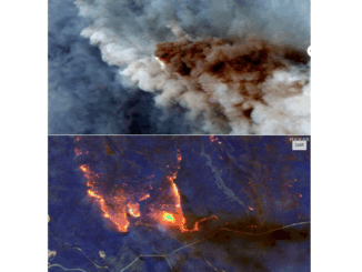
Satellite images capture major events of 2020. The pandemic brought the world to a grinding halt in 2020, however that did not stop satellites from orbiting the Earth. In this article, notable events that shaped […]