Community
Wanted – A GNSS Puck
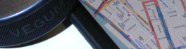
“I want it! I want it! I want it!” – “Magic Bus” – The Who The Glass Floor. There is glass floor of precision and accuracy that has sometimes been a hindrance to geospatial field […]
“I want it! I want it! I want it!” – “Magic Bus” – The Who The Glass Floor. There is glass floor of precision and accuracy that has sometimes been a hindrance to geospatial field […]

GAC 2015 Supports the GIS Education Community Everything begins and ends with geospatial information. Now more than ever, GIS and geomatics methodologies are gaining wide acceptance and adoption. GIS and geomatics tools were once […]
EDC Provides Hispasat with Euro 123 M to Purchase a Satellite from Vancouver’s MDA Export Development Canada (EDC) today announced financing of Euro 123 M to Hispasat, a Spanish satellite telecommunications operator, for the construction […]
GoGeomatics is pleased to publish the news that Simon Banville, a Ph.D. student in the Department of Geodesy and Geomatics Engineering on the University of New Brunswick Fredericton campus, has won this year’s Institute of […]
Satellite-based Earth Observation (EO) is a process of using remote-sensing technique to gather information on the chemical, physical and biological aspects of the earth system. This technique allows the measurement of geophysical parameters of the […]
DigitalGlobe has released the first images taken with the Exelis-built (NYSE: XLS) integrated, super-spectral imaging system on the WorldView-3 satellite, which launched last week from Vandenberg Air Force Base in California. The images, taken at […]
The federal Minister of State for Science and Technology, Ed Holder, visited the University of New Brunswick on 28 July to announce the awarding by the Natural Sciences and Engineering Council of $2.4 million to […]
The Canadian Geomatics Community Round Table is beginning to implement the Pan-Canadian Geomatics Strategy which seeks to guide and support the Geomatics sector in Canada. The group of people involved with the Round Table comes […]