series
A Canadian Geographer’s Notes from Nunavut
For the last five years, I have annually had the opportunity to spend time in Iqaluit, Canada’s fastest growing community in Canada’s fastest growing territory or province. On arrival, I check out the selection of new books at Arctic Ventures and the screening of new movies about the North. This year, there was the chance to see John Walker’s Passage and to buy a copy of Darrel Varga’s book of the same name in the Canadian Cinema series.
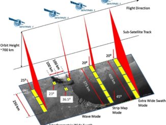
Free Satellite Imagery For You: Sentinel 1 & 2
Sentinel constellations and data products As the ENVISAT program is coming to an end, the European Space Agency has begun…
My COGS GIS Education, Part II
In my first article, I introduced the how and why I chose to attend COGS from the fall of 2014…
WEBINAR March 29: GSDI Coastal and Marine SDI Best Practices
COINAtlantic would like to extend an invitation on behalf of the Global Spatial Data Infrastructure (ASDI) Association to participate in…
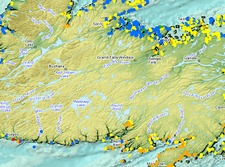
Toronto & Calgary: Federal Floodplain Mapping Workshop March 28th & 30th
The Federal Floodplain Mapping Guidelines workshop, hosted by Canadian Water Resources Association (CWRA) on behalf of the Government of Canada,…
GNOSIS – A New Geomatics Software Suite
Creating a new GIS from scratch is a tough undertaking. It involves a lot of innovation. Ecere, a Canadian company…
Event Recap: COGS & CIG & GANS Cooperate for Mapping Workshop
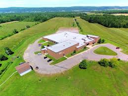
The Canadian Institute of Geomatics (CIG) Nova Scotia Branch and the Geomatics Association of Nova Scotia (GANS), two regional professional organizations that foster the application of geographic information within the geomatics sector recently collaborated to host a high resolution mapping workshop at the Centre of Geographic Sciences (COGS) in Lawrencetown, Nova Scotia.
Software Development – The Key to Ecere’s Success
It is rare to learn of a GIS company in which much R&D is done up front to create the…
Canadian Geomatics Innovation: Ecere Develops a Next Generation GIS
Not many companies undertake the ambitious goal of creating a new geospatial software suite from scratch. Ecere, a Canadian company…
Interview with Ted Mackinnon: Promoting Canadian GIS & Geomatics on Twitter
GoGeomatics has been actively using Twitter to reach out to the geospatial community since 2009. We have written and hosted…
A List of Geospatial Open Data Resources in Canada
Recently, I read an article about the Canadian Geospatial Data Infrastructure (CGDI) that seeks to explain why the CGDI, among many…
Call to Action: Network of Concerned Geographers
Our growing network – the Network of Concerned Geographers – is pressuring the American Association of Geographers to study and…