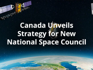
Space
How Deploy Solutions can help bridge the communications gap in times of climate change crisis
Our Changing Climate The world we live in is changing, with global warming reshaping climate and causing more frequent, more…
Building Software Solutions for Climate Change: Closing the communication gap between citizens and trusted authorities before, during, or after a disaster
A Climate Change Problem: The Communication Gap between Citizens and Authorities At a time of rising climate change impacts, there…
International Geospatial Briefing February 22nd – AMAZON AWS into space sector; UAE’s Hope mission; Map the world’s youngest & oldest countries; India’s indigenous mapping portal; Archaeology from space; Mapping campus love stories
The GoGeomatics team brings to you interesting stories and content related to geospatial technologies, space missions, innovative use of maps,…
International Geospatial Briefing February 9th – What are we doing about space traffic management?; new urban planning GIS tool to improve urban climate resilience; Drone Privacy Laws; World’s Longest and Deepest Alternating Current Cable Route; Ex-Uber team – Unfolded.ai
What are we doing about space traffic management? As spaceX continues to launch more and more satellites through their ridesharing…
Canadian Space Agency announced a new funding opportunity
The Announcement of Opportunity is intended to address these issues by supporting the development of advanced space-based products and solutions aligned with…
GeoIgnite 2020 Video: Deploy Solutions Space Social: Nick Kellet & Kevin Jones
GeoIgnite is Canada’s national geospatial conference hosted by GoGeomatics Canada. GeoIgnite was held online via Zoom from July 22nd to…
GeoIgnite 2020: Growing Canada’s Next Earth Observation (EO) Generation
GeoIgnite is Canada’s National Geospatial conference hosted by GoGeomatics Canada. GeoIgnite was held online using Zoom July 22nd to 24th,…
Book Review- Sarah Parcak’s ‘Archaeology from Space’
What a great time to be a geospatial specialist. The impact of location technology continues to grow. I am excited…
Announcing Canada’s Remote Sensing and Space Industry Podcast: Northern View
Kevin Jones and Mauro Scatozza, Canadian remote sensing sector insiders, have launched an exciting new podcast. For everyone in the geomatics…
NASA: a view of Hurricane Dorian from space
Satellites operated by NASA and the National Oceanic and Atmospheric Administration (NOAA) continue to track its movement and progress. You can…
Your Canadian Geospatial Briefing for June 3rd: Mapbox; Location Tech myths; Maxar; Apple Maps; UrtheCast
Mapbox joins GeoIgnite 2019 GeoIgnite has a new platinum sponsor! Location data platform Mapbox is joining the top decision makers and…
Your Canadian Geospatial Briefing for November 13th: NRCan and OGC; RASC; Concordia University; Canada’s Commemorative Map; IN-FLIGHT Data
NRCan becomes OGC strategic member GeoConnections of Natural Resources Canada (NRCan) has upgraded to the highest level of membership—strategic member—in…