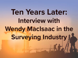
• facebook
  • Twitter
  • Linkedin
  • Youtube
  • Linkedin Group
  • Post a Job
  • Post an Ad
  • Post an Event
  • Post a Directory Listing
  • Post a Press Release
  • Media Kit
  • My Account
  • Login
GoGeomatics
  • MAGAZINE
    • BIM & GIS
    • Community
    • Conference news
    • Earth Observation
    • Education & Careers
    • GEOAI
    • Announcements
    • Reality Capture & Lidar
    • Science
    • Technology
  • Directories
    • ASSOCIATION
    • INDUSTRY
    • EDUCATION
    • Open Data
  • EVENTS
    • GeoIgnite Events
    • Events Calendar
    • GoGeomatics Meetups
  • Services
    • Advertising
    • Marketing
    • Post a Job
    • Post an Ad
    • Post an Event
    • Post a Press Release
    • Post a Directory Listing
    • Media Kit
    • Web Design
  • Find a Job
  • Volunteer
    • Start a GoGeomatics Group
    • Editors & Writers Group
  • About Us
    • About Us
    • Contact Us
    • Frequently Asked Questions
  • Videos
HomeSurvey

Survey

||
Technology

The ACLS Wants You: Geodetic Datum Dependencies Survey

1 November 2022 GoGeomatics Canada | ACLS

The Association of Canada Lands Surveyors (ACLS) invites you to participate in the Geodetic Datum Dependencies Survey. It is a national effort to “modernize and unify” geodetic reference systems in Canada. The Canadian Geodetic Survey […]

|||||||||||||||||||||||||||||||||||
Community

2022 Back to School Socials in Pictures – Thank you Sponsors & Participants!

29 September 2022 GoGeomatics Canada | alberta

The 7th annual GoGeomatics 2022 Back to School Socials have been a tremendous success. Our groups and group leaders across the country came together to put together some great events. Many thanks go to our […]

||||||
Technology

NV5 Geospatial Supports Natural Resources Canada in Topobathymetric Lidar Survey of South and North Saskatchewan Rivers

6 June 2022 Sven Cowan | Canada

Over the last decade, a growing number of municipal and regional governments across North America have invested in topobathymetric lidar surveys of lakes, rivers and watersheds. Regional governments often commission new lidar survey projects, along […]

|
Newsmakers & Press Releases

The State of Mobile Mapping 2022 is here: You’re invited to take part in the industry survey of the year

24 May 2022 GoGeomatics Canada | 3D

You’re invited to take part in one of the biggest and most ambitious surveys ever conducted about mobile mapping. NavVis, in partnership with Lidar News, Lidar Magazine, the American Surveyor, GoGeomatics, GIM International, Geo Week, […]

||||
Technology

NV5 Geospatial Helps Okanagan Basin Water Board Protect Important Local Communities Through Near-Shore Topobathymetric Lidar Survey

25 March 2022 Sven Cowan | British Columbia

The Okanagan Valley in British Columbia is one of Western Canada’s most attractive tourist destinations, with local communities offering a range of active and relaxing activities organized around the region’s many lakes and rivers. The […]

|
Community

Take the Survey: Canadian “Geo” Associations Survey

16 November 2020 Jon Murphy | associations

GoGeomatics Canada is conducting a survey of the Canadian geospatial community to see what you think about associations in our sector. We will share the results with the community on this magazine as well in […]

|||||||||||
Community

Results: Pandemic Survey of the Canadian Geospatial Sector

2 November 2020 Jon Murphy | 2020

In October of 2020, GoGeomatics Canada conducted a survey of how the Canadian geospatial sector was coping with the global pandemic. What follows are results and some analysis of the survey. The survey was sent […]

Technology

Canadian Geospatial Briefing for October 7th: EA Event Hosted By Government of Canada; Geosapiens Startup Business; Drone Delivery Canada; Alberta Greenhouse Report

7 October 2020 GoGeomatics Newsmakers | Alberta Agriculture

The Government of Canada to host webinar for its Space-Based Earth Observation strategy Canada Space Agency(CSA) has released which defines Space-Based Earth Observation (SBEO). The paper was discussed at the 41st Canadian Symposium on Remote […]

Posts pagination

« 1 2 3 … 40 »

Events

Notice
There are no upcoming events.

View All Events

Services

  • Post a Job
  • Post an Ad
  • Post an Event
  • Post a Directory Listing
  • Post a Press Release
  • Media Kit
  • My Account
  • Login

Jobs

Post a Job
  • Canada Maps and Poster Gallery Volunteer Leads — GeoIgnite 2026
    remote
  • GIS & Data Analytics Lead
    Beaumont, AB
  • Lead Surveyor, Projects/Arpenteur-géomètre principal, projets; arpenteuse-géomètre principale, projets
    North Bay, Thunder Bay
  • Senior GIS Developer
    Calgary, AB
View All Jobs
  • Directories
    • Associations Directory
    • Industry Directory
    • Education Programs
    • Open Data
  • Volunteer
    • Start a GoGeomatics Group
    • Editors & Writers Group
  • About Us
    • GoGeomatics Media Kit
    • Who We Are
    • Contact Us
    • FAQ’s
    • Advertising
    • Marketing
  • Subscribe
GoGeomatics
GoGeomatics is the largest and most popular communications hub promoting the Canadian geospatial community. The business was incorporated in 2011. GoGeomatics hosts over 100 fun, free, location technology networking events each year in cities across Canada.

© 2025 GoGeomatics

  • facebook
  • Twitter
  • Linkedin
  • Youtube
  • Linkedin Group