• facebook
  • Twitter
  • Linkedin
  • Youtube
  • Linkedin Group
  • Post a Job
  • Post an Ad
  • Post an Event
  • Post a Directory Listing
  • Post a Press Release
  • Media Kit
  • My Account
  • Login
GoGeomatics
  • MAGAZINE
    • BIM & GIS
    • Community
    • Conference news
    • Earth Observation
    • Education & Careers
    • GEOAI
    • Announcements
    • Reality Capture & Lidar
    • Science
    • Technology
  • Directories
    • ASSOCIATION
    • INDUSTRY
    • EDUCATION
    • Open Data
  • EVENTS
    • GeoIgnite Events
    • Events Calendar
    • GoGeomatics Meetups
  • Services
    • Advertising
    • Marketing
    • Post a Job
    • Post an Ad
    • Post an Event
    • Post a Press Release
    • Post a Directory Listing
    • Media Kit
    • Web Design
  • Find a Job
  • Volunteer
    • Start a GoGeomatics Group
    • Editors & Writers Group
  • About Us
    • About Us
    • Contact Us
    • Frequently Asked Questions
  • Videos
HomeTeam

Team

|||
Technology

PredictION: Routing & Modeling App for Proposed Transit Projects

17 June 2015 Team PredictION | 2015

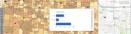
PredictION is an app that provides transit authorities with a unique approach to engage and inform the public. By making use of General Transit Feed Specifications, PredictION will allow users to predict the impacts of […]

||||
Education & Careers

GGE Images Kings Landing Historical Settlement in 3D

15 June 2015 University of New Brunswick | 2014

During the summer and fall of 2014, a team of researchers from the Department of Geodesy and Geomatics Engineering at UNB carried out the first three-dimensional survey of Kings Landing Historical Settlement, a living history […]

No Picture
Community

CloverPoint to Showcase Insight(TM) and Latest in Mapping Technology at TECTERRA 2015 Geomatics Show

15 June 2015 GoGeomatics Newsmakers | 2015

CloverPoint will be presenting our latest GIS, mapping, and land management solutions used by First Nations, and facility managers at the annual TECTERRA Geomatics Showcase in Calgary, Alberta #TECTERRASC15 CloverPoint, an established player in the […]

No Picture
Newsmakers & Press Releases

GeoDecisions’ GeoILS Intelligent Location Server Used to Track Icebergs

11 June 2015 GoGeomatics Newsmakers | ArcGIS

A Canadian expedition team used GeoDecisions’ GeoILS® platform to help track icebergs during a voyage to better understand how icebergs drift. An intelligent location server using the Esri® ArcGIS platform, GeoILS enables users to monitor […]

|||
Technology

ECCE APP Challenge Experience –Team CODE

9 June 2015 Jin Xing | api

Team CODE is made up of myself (Jin Xing), Carl Hughes, and Matthew Tenney. We all come from Roger Tomlinson lab at McGill University. Matthew and I are supervised by Professor Renee Sieber, leader of […]

No Picture
Newsmakers & Press Releases

BlackBridge and EarthSTAR Bring RapidEye Imagery and Solutions to the People’s Republic of China

3 June 2015 GoGeomatics Newsmakers | agriculture

Berlin — BlackBridge announced that it has entered into a sole distribution agreement with EarthSTAR Inc. to provide RapidEye imagery and solutions to the People’s Republic of China, including Hong Kong and Macau. EarthSTAR Inc., a subsidiary of EarthView Image […]

No Picture
Newsmakers & Press Releases

SimActive Provides Integrated LiDAR and Photo Solution to Altoa

2 June 2015 GoGeomatics Newsmakers | 2015

Montreal, Canada, June 2nd, 2015 – SimActive Inc., a world-leading developer of photogrammetry software, is pleased to announce the purchase of its Correlator3D™ software by Altoa from French Guiana. The software will be used to […]

No Picture
Newsmakers & Press Releases

Seisland Surveys Wins Esri Canada’s Award of Excellence in GIS

28 May 2015 GoGeomatics Newsmakers | 2015

Cloud-based oil and gas information management solution supports effective emergency response CALGARY, Esri Canada User Conference – May 27, 2015 – Rapid access to asset information is valuable to companies in nearly all industries, especially […]

Posts pagination

« 1 … 10 11 12 … 28 »

Events

Notice
There are no upcoming events.

View All Events

Services

  • Post a Job
  • Post an Ad
  • Post an Event
  • Post a Directory Listing
  • Post a Press Release
  • Media Kit
  • My Account
  • Login

Jobs

Post a Job
  • Canada Maps and Poster Gallery Volunteer Leads — GeoIgnite 2026
    remote
  • GIS & Data Analytics Lead
    Beaumont, AB
  • Lead Surveyor, Projects/Arpenteur-géomètre principal, projets; arpenteuse-géomètre principale, projets
    North Bay, Thunder Bay
  • Senior GIS Developer
    Calgary, AB
View All Jobs
  • Directories
    • Associations Directory
    • Industry Directory
    • Education Programs
    • Open Data
  • Volunteer
    • Start a GoGeomatics Group
    • Editors & Writers Group
  • About Us
    • GoGeomatics Media Kit
    • Who We Are
    • Contact Us
    • FAQ’s
    • Advertising
    • Marketing
  • Subscribe
GoGeomatics
GoGeomatics is the largest and most popular communications hub promoting the Canadian geospatial community. The business was incorporated in 2011. GoGeomatics hosts over 100 fun, free, location technology networking events each year in cities across Canada.

© 2025 GoGeomatics

  • facebook
  • Twitter
  • Linkedin
  • Youtube
  • Linkedin Group