• facebook
  • Twitter
  • Linkedin
  • Youtube
  • Linkedin Group
  • Post a Job
  • Post an Ad
  • Post an Event
  • Post a Directory Listing
  • Post a Press Release
  • Media Kit
  • My Account
  • Login
GoGeomatics
  • MAGAZINE
    • BIM & GIS
    • Community
    • Conference news
    • Earth Observation
    • Education & Careers
    • GEOAI
    • Announcements
    • Reality Capture & Lidar
    • Science
    • Technology
  • Directories
    • ASSOCIATION
    • INDUSTRY
    • EDUCATION
    • Open Data
  • EVENTS
    • GeoIgnite Events
    • Events Calendar
    • GoGeomatics Meetups
  • Services
    • Advertising
    • Marketing
    • Post a Job
    • Post an Ad
    • Post an Event
    • Post a Press Release
    • Post a Directory Listing
    • Media Kit
    • Web Design
  • Find a Job
  • Volunteer
    • Start a GoGeomatics Group
    • Editors & Writers Group
  • About Us
    • About Us
    • Contact Us
    • Frequently Asked Questions
  • Videos
HomeTerra Remote Sensing

Terra Remote Sensing

Technology

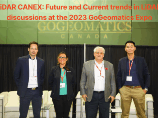
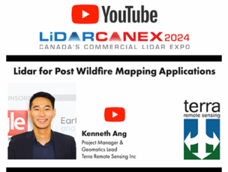
LiDAR for Post Wildfire Mapping Applications at Lidar CANEX 2024

12 April 2024 Crystal Fitzpatrick | BC Ministry of Transportation and Infrastructure

Kenneth Ang, Project Manager and geomatics Lead at Terra Remote Sensing, recently presented at Lidar CANEX 2024 on LiDAR for post-wildfire mapping applications. Kenneth provided an overview of Terra Remote Sensing, with a specific focus […]

Technology

LiDAR CANEX: Future and Current trends in LiDAR discussions at the 2023 GoGeomatics Expo

23 November 2023 Kenneth Ang | gogeoexpo2023

At the 1st ever Geospatial Expo in Canada hosted by GoGeomatics, I was privileged to moderate the LiDAR CANEX panel. The panel was joined by Dr Tim Webster a research scientist from Nova Scotia Community […]

|||||
Technology

High Resolution Remote Sensing Supports Victoria International Airport’s Operations

10 February 2023 Kenneth Ang | airports

Introduction In a recent project for Victoria International Airport (YYJ), Terra Remote Sensing Inc (TRSI) acquired high resolution photogrammetry and LiDAR data sets. These were acquired at 2cm resolution for the imagery and 30 points […]

Events

Notice
There are no upcoming events.

View All Events

Services

  • Post a Job
  • Post an Ad
  • Post an Event
  • Post a Directory Listing
  • Post a Press Release
  • Media Kit
  • My Account
  • Login

Jobs

Post a Job
  • Canada Maps and Poster Gallery Volunteer Leads — GeoIgnite 2026
    remote
  • GIS & Data Analytics Lead
    Beaumont, AB
  • Lead Surveyor, Projects/Arpenteur-géomètre principal, projets; arpenteuse-géomètre principale, projets
    North Bay, Thunder Bay
  • Senior GIS Developer
    Calgary, AB
View All Jobs
  • Directories
    • Associations Directory
    • Industry Directory
    • Education Programs
    • Open Data
  • Volunteer
    • Start a GoGeomatics Group
    • Editors & Writers Group
  • About Us
    • GoGeomatics Media Kit
    • Who We Are
    • Contact Us
    • FAQ’s
    • Advertising
    • Marketing
  • Subscribe
GoGeomatics
GoGeomatics is the largest and most popular communications hub promoting the Canadian geospatial community. The business was incorporated in 2011. GoGeomatics hosts over 100 fun, free, location technology networking events each year in cities across Canada.

© 2025 GoGeomatics

  • facebook
  • Twitter
  • Linkedin
  • Youtube
  • Linkedin Group