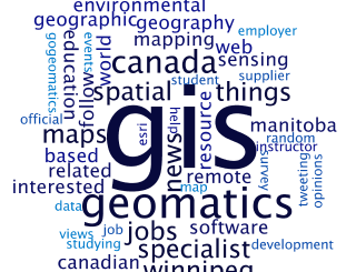
• facebook
  • Twitter
  • Linkedin
  • Youtube
  • Linkedin Group
  • Post a Job
  • Post an Ad
  • Post an Event
  • Post a Directory Listing
  • Post a Press Release
  • Media Kit
  • My Account
  • Login
GoGeomatics
  • MAGAZINE
    • BIM & GIS
    • Community
    • Conference news
    • Earth Observation
    • Education & Careers
    • GEOAI
    • Announcements
    • Reality Capture & Lidar
    • Science
    • Technology
  • Directories
    • ASSOCIATION
    • INDUSTRY
    • EDUCATION
    • Open Data
  • EVENTS
    • GeoIgnite Events
    • Events Calendar
    • GoGeomatics Meetups
  • Services
    • Advertising
    • Marketing
    • Post a Job
    • Post an Ad
    • Post an Event
    • Post a Press Release
    • Post a Directory Listing
    • Media Kit
    • Web Design
  • Find a Job
  • Volunteer
    • Start a GoGeomatics Group
    • Editors & Writers Group
  • About Us
    • About Us
    • Contact Us
    • Frequently Asked Questions
  • Videos
Hometools

tools

No Picture
Education & Careers

Planning an Enterprise GIS from the Bottom Up

8 December 2016 Ozair Khan | analysis

You might be an observant professional in a department that uses GIS. Your organization may be large and have many departments for which location is important. If that is the case, there is a strong […]

|||
Community

Contrasting: GIS & Geomatics Education in Canada and China

30 November 2016 Francis Guo | analysis

I have studied Geographic Information Systems (GIS) in both Canada and China. Last summer I completed my master in geography at University of Waterloo. In this article I will draw upon my experiences in China and […]

|
Education & Careers

Geospatial Development: Enhancing GIS curricula with programming skills at UNB

29 November 2016 Emmanuel Stefanakis | 2014

Geospatial information science and technology (GIS&T) has rapidly evolved over the last few decades. This evolution has created a highly demanding job market for GIS professionals [3,4]. Recently, students, graduates, and professionals are more and […]

||||||||||
Education & Careers

Easy Access to Data: The CGDI Initiative

28 November 2016 Elaha Akrami | 2013

The Canadian Geospatial Data Infrastructure (CGDI) is an initiative of Natural Resources Canada that began in 2001. The CGDI does not refer to a specific database, but rather a collection of Canadian geospatial resources available […]

Newsmakers & Press Releases

what3words adopted by six national mapping agencies

25 November 2016 GoGeomatics Newsmakers | 2013

what3words, the multi-award winning location reference system, has today announced that six national mapping agencies have adopted 3-word addresses. Used to input and share locations within national online geoportals, what3words is making it simpler for […]

|||||
Education & Careers

The Art of Being a Cadastral Surveyor: Key abilities every surveyor needs

16 November 2016 Manminder 'Meena' Kaur | 3D

The Art of Being a Cadastral Surveyor:  The key abilities every surveyor needs There is an art to being a land surveyor.  Surveyors take extremely accurate measurements with sophisticated tools to create plans that become legal […]

||
Education & Careers

What are the Top Programming Languages in the GIS World?

16 November 2016 Florin-Daniel Cioloboc | 2016

Image source: www.tiobe.com Every now and again we hear about the importance of programming for Geographic Information Systems(GIS) professionals, that is quickly becoming a key in the evolution of one’s career. It is argued that […]

||||||||||
Education & Careers

Erosion of Geography in Canadian High Schools

8 November 2016 Robert Maher | Canadian Association of Geographers

Mount Allison University campus This weekend, I drove up to Mount Allison University situated in Sackville, New Brunswick, to participate in the Atlantic chapter of the Canadian Association of Geographers’ (CAG) workshop on Geography education. […]

Posts pagination

« 1 … 3 4 5 … 27 »

Events

Notice
There are no upcoming events.

View All Events

Services

  • Post a Job
  • Post an Ad
  • Post an Event
  • Post a Directory Listing
  • Post a Press Release
  • Media Kit
  • My Account
  • Login

Jobs

Post a Job
  • Canada Maps and Poster Gallery Volunteer Leads — GeoIgnite 2026
    remote
  • GIS & Data Analytics Lead
    Beaumont, AB
  • Lead Surveyor, Projects/Arpenteur-géomètre principal, projets; arpenteuse-géomètre principale, projets
    North Bay, Thunder Bay
  • Senior GIS Developer
    Calgary, AB
View All Jobs
  • Directories
    • Associations Directory
    • Industry Directory
    • Education Programs
    • Open Data
  • Volunteer
    • Start a GoGeomatics Group
    • Editors & Writers Group
  • About Us
    • GoGeomatics Media Kit
    • Who We Are
    • Contact Us
    • FAQ’s
    • Advertising
    • Marketing
  • Subscribe
GoGeomatics
GoGeomatics is the largest and most popular communications hub promoting the Canadian geospatial community. The business was incorporated in 2011. GoGeomatics hosts over 100 fun, free, location technology networking events each year in cities across Canada.

© 2025 GoGeomatics

  • facebook
  • Twitter
  • Linkedin
  • Youtube
  • Linkedin Group