united nations
Examining greenhouse gasses from space
Barbara Ryan to continue discussions held at the UN on research findings In late 2019, Barbara Ryan, executive director of…
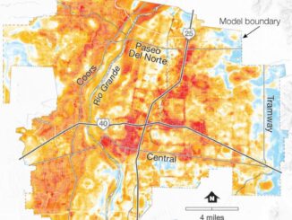
International Geospatial Briefing Dec 6: 1. GPR Painting New Pictures of the Past; 2. Satellite Imagery to Support Clean Water for All; 3. Summer Heat and Environmental Inequality in Albuquerque; 4. Remote Sensing Keeping an Eye on Deforestation; 5. Educating a Skilled Geospatial Workforce in Somalia; 6. Announcing The Virtual Subsurface Utility Mapping Strategy Forum Conference
Ground Penetrating Radar Providing New Insights for Archaeologists New applications of ground penetrating radar (GPR) are allowing archaeologists to gain…
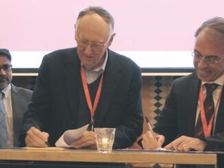
Collaboration between WGIC and UN mark new milestone strengthening global geospatial information ecosystem
Geospatial World Forum 2019, bringing together more than a thousand industry thought leaders from over 75 countries in Amsterdam, had…
Your Global Geospatial Briefing for December 17th: ICEYE-X2; 2018 in big data; London smart city awareness; Collect Earth Online; Geo4SDGs
ICEYE-X2 publishes first image The world’s largest Synthetic-aperture radar (SAR) satellite constellation built by ICEYE has published its first image.…
Indian Social Entrepreneur Wins the First UN Geospatial Ambassador Award
Sanjay Kumar, Founder and CEO of Geospatial Media & Communications, was conferred the ‘Global Geospatial Industry Ambassador’ Award by UN-GGIM (United Nations…
Your Global Geospatial Briefing for September 11th: United Nations Sustainable Development Goals; Drone Racing League; Planet and Copernicus; Early Surveyors; Smart City projects; GPS jamming
The UN moves forward with Sustainable Development Goals The United Nations has taken a major step towards sustainability with the…
Toronto & Calgary: Federal Floodplain Mapping Workshop March 28th & 30th
The Federal Floodplain Mapping Guidelines workshop, hosted by Canadian Water Resources Association (CWRA) on behalf of the Government of Canada,…
Vancouver Geospatial Career Seminar February 23rd
GoGeomatics Canada is bringing our popular career seminar to Vancouver this February. This is only the second time we have…
Volunteer & Map Canada: Statistics Canada Crowdsourcing Pilot Project
Statistics Canada has launched a new pilot project using OpenStreetmap. For many Canadians outside of the geomatics community this is…
Canada Takes Part: Arctic Spatial Data Infrastructure Meets in Anchorage
The Arctic SDI Board, which includes mapping executives from Canada, Kingdom of Denmark, Finland, Iceland, Norway, Russia, Sweden and the…
Where are the GIS & Geomatics Jobs in Canada for 2016
Where are the Geomatics job opportunities in Canada? I’ve got some good news and I’ve got some bad news. Let’s start…
UN General Assembly urges sharing of geospatial data to benefit people and planet
New York – The science that supports the precise pinpointing of people and places should be shared more widely, according…