unmanned

Drone World Expo Conference Program Will Provide a Road Map for Commercial Drone Solutions

A world-class conference program and several new educational and networking features will take place at the 2nd annual Drone World…

SNRC: UAV Integration Highly Valued in Canadian Marketplace

Due to a foreseeable increase in the demand for UAV acquired aerial imagery in resource management, various firms are already…

2016 Student UAS Competition- Phase 1 Winners

Phase 1 of the 2016 Student UAS Competition is complete. A judging panel, comprised of Canadian subject matter experts, has…

Low-cost Feature-Rich RTK Receiver

SkyTraq Technology, a Taiwanese GNSS positioning technology company, introduces S2525F8-RTK, a low-cost, low-power, single frequency RTK receiver for applications requiring…

UAV Technology in the Canadian Forestry Sector

The Unmanned Aerial Vehicle (UAV) industry is soaring! Civilian drones are being applied in various global industries ranging from agriculture…

2016 Canadian Geomatics Events & Conferences

This is our list Canadian geomatics conferences and events for 2016. Here you will find events pertaining to GIS, remote…

FAA Announces Small UAS Registration Rule

For Immediate Release December 14, 2015 Contact: Les Dorr or Alison Duquette Phone: (202) 267-3883 Registration Begins on December 21,…

Transport Canada encourages new drone users to learn rules before flying

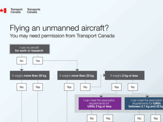
With popular holiday gift comes great responsibility OTTAWA, Dec. 11, 2015 /CNW/ – Drones, also known as unmanned air vehicles,…

FAA Task Force recommends registration for drones over 9 ounces

A Federal Aviation Administration task force has recommended requiring owners of all drones larger than 9 oz. (250 grams) to…

Presagis Showcases New Modeling and Simulation Software Suite at I/ITSEC 2015

Unmanned Aerial Systems Border Surveillance demo reveals the realism, power and versatility of Presagis’ M&S Suite 15 MONTREAL, CANADA–(Marketwired –…

Archaeology & UAV: AG-Wing has covered 41,250 Acres in Easter Island

AG-Wing small unmanned aerial system has covered the whole Easter Island in about a week, 41,250 acres in the southeastern…

Montreal: AeroVironment Chooses SimActive’s Correlator3D™

Montreal, Canada, September 22nd, 2015 – SimActive Inc., a world-leading developer of photogrammetry software, is pleased to announce that AeroVironment…