
Geospatial Career Webinar
Finding a job in geospatial technology can be difficult, and we want to give job seekers the tools and techniques that will help them succeed. The career webinar will take place on August 24 from […]
Finding a job in geospatial technology can be difficult, and we want to give job seekers the tools and techniques that will help them succeed. The career webinar will take place on August 24 from […]

Canada’s Lidar Expo is coming to you on March 26th, including a workshop day on March 27, 2024. GoGeomatics Canada, the popular and influential geomatics communications hub, is bringing you an online event where reality […]
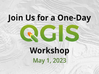
Are you a GIS professional, a new GIS user, or even someone with an interest in GIS? Join us for 1 Day Introduction to QGIS, an accredited, eight-hour workshop (9am to 5pm) on May 1, […]
GoGeomatics celebrated Geography Awareness Week and GIS day 2022 by hosting a series of talks and webinars. We could not have celebrated Geography week any other way! Canadian Geospatial Workforce Roundtable Discussion: How have work […]
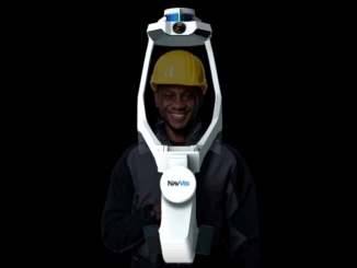
Get ready, engineers, surveyors, and geospatial professionals. A new wearable mobile mapping system is coming to Canada, NavVis VLX. NavVis was introduced to Canada during a LiDAR Comex 2022 presentation, where NavVis was a Platinum […]
Are you struggling when communicating your value to job-seekers? Are you struggling to develop a strong marketing campaign? Do you need of staff but still need to turn down projects because there is a lack […]

SafeGraph’s Canada Core Places (Essential Columns) dataset is available for free in the AWS Data Exchange. To use this POI data to conduct a market analysis, follow the steps below. Getting Started 1. Sign up […]

The Government of Canada to host webinar for its Space-Based Earth Observation strategy Canada Space Agency(CSA) has released which defines Space-Based Earth Observation (SBEO). The paper was discussed at the 41st Canadian Symposium on Remote […]