
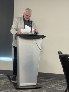
At GeoIgnite 2025 in Ottawa, Luc Vaillancourt, founder of BALIZ, delivered one of the event’s most thought-provoking talks: “Two Solitudes in Geomatics.” Drawing inspiration from Canadian literature and culture, Vaillancourt used the metaphor of “two solitudes” to describe the disconnect between different sectors and mindsets within Canada’s geomatics community—particularly between private industry and public institutions, technologists and strategists, legacy systems and innovation.
His call for deeper collaboration across these divides struck a chord with many in attendance, prompting reflection on how the industry can better align to meet the evolving demands of data-driven decision-making, climate resilience, and digital transformation.
During the conference, we had the opportunity to sit down with Vaillancourt to explore these themes further. In a wide-ranging conversation, he shared insights on his professional journey—from founding KOREM to launching his consultancy Baliz—as well as his perspectives on business development, strategic storytelling, and what it takes to truly modernize geospatial practice in Canada.
Excerpts from the conversation:
From KOREM to Baliz: A Lifelong Geospatial Journey
Vaillancourt launched KOREM in 1993, growing it into a reputable mapping and systems integration company. After leaving in 2005, he founded Baliz, a solo consulting business focused on supporting both users of geospatial technology—such as Quebec government agencies—and geospatial companies in need of business development, strategy, partnerships, and commercialization guidance.
“I’m not a technical consultant,” Luc explains. “I help companies with their aura—how they are perceived, how they position themselves, and how they tell their story.”
The Industry’s Messaging Problem: A ‘Groundhog Day’ Scenario
When asked if geospatial awareness has grown, Luc compares the industry to the movie Groundhog Day. “We repeat the same speech and face the same challenges—messaging, positioning, marketing.”
Luc believes the industry continues to struggle to clearly communicate its value. “We always start by talking about data acquisition—satellites, LiDAR, drones. But we should be starting at the end: the user experience. The map, the report, the dashboard.”
He argues that true value lies in the application, not the collection. “If users see the end result first, they’re more likely to care about what’s needed to get there, including the expensive and complex data acquisition.”
Too Much Focus on Collection, Not Enough on Use
Vaillancourt humorously suggests to change focus: “Pause data acquisition for two years.” Instead, redirect efforts toward processing and application. “There’s too much money and attention on acquiring new data. What we need is better usage and more compelling outcomes.”
He likens the situation to farming. “We talk endlessly about the tractors and harvesters, but we forget the muffin. People want the muffin.”
While open data is often celebrated, Luc is skeptical. “A lot of it is low quality—wrong data types, poorly structured tables. It gives a false sense of usability.”
He warns against if availability equals utility. “Just because data is open doesn’t mean it’s useful.”
A Wake-Up Call for Education and Recruitment
The geospatial talent pipeline is also at risk. Luc points to the lack of visibility of geospatial programs in schools and universities. “You can’t dream of being something if you don’t know it exists. Schools need to better market their programs. The industry needs to be more attractive.”
He also notes that many qualified GIS professionals remain “unseen” in the job market.
His advice?
Think laterally. “Look at data science or IT jobs that could use a geo-flavor. Geo is just a dimension—like time or identity. You don’t need to only apply for ‘geo’ jobs.”
What the Industry Needs
Luc Vaillancourt’s call to action is clear:
- Start with user value: Maps, answers, decisions—not drones and sensors.
- Improve communication and marketing: Speak clearly and compellingly.
- Focus on education: Make geospatial programs visible and exciting.
- Diversify job thinking: Don’t be boxed in by titles—geo skills are valuable everywhere.
- Shift the investment focus: From collection to transformation and results.
“The entire ecosystem—from schools to companies to associations—needs to align around value and communication. Only then can we grow geospatial into what it’s meant to be.”


Be the first to comment