
GoGeomatics Canada is looking to the west of Canada and speaking with Tracey Harvey GIS instructor at Selkirk College in BC.
GoGeomatics: Hi Tracey and welcome back to the GoGeomatics Canada community. Tracey you were kind enough to do an interview with us previously about your career so lets concentrate on the GIS program at Selkirk.
Tracey Harvey: Thanks for inviting me!
GoGeomatics: Can you tell us a little about the history of the GIS program at your school?
Tracey Harvey: Nearly 10 years ago in 2003, Donna Delparte led the initiation of the GIS program at Selkirk College. She has since moved on to the University of Hawaii where she now teaches.
At that time we only offered a one-year Advanced Diploma, similar to what both BCIT and COGS also offer.
In 2006, we added a Bachelor of GIS (BGIS) to our credentials and now we’re undergoing a curriculum renewal process and hoping to also offer an online GIS Certificate, geared towards the working professional who wants to apply GIS to their field of expertise. It would also give people enough skill to succeed in an entry level GIS position.
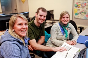
For a small regional community College, we’re super proud to offer such quality education. We see about 2400 full time learners a year within our 60 different programs. Within our GIS program we have maximum enrolment of 16 face to face learners. We value our small and personable classes. We like to say the Selkirk experience goes far beyond the classroom – like out on to the trails, ski hills, rivers….most of us share an outdoor passion.
GoGeomatics: Selkirk has two streams for GIS. You have an advanced diploma program and a BGIS. Can you compare and contrast the two.
Tracey Harvey: The Advanced Diploma is the core program; it contains all of the required technical courses for both the ADGIS and BGIS. It’s a fast paced year that finishes off with a paid co-op work term. If learners want a more rounded education, we encourage continuing on to the BGIS which includes more geography courses and business electives as well as a research project, putting all the learned skills into use.
We refer to the ADGIS as Year 3 and the BGIS as Year 4 since entry into the ADGIS is an undergrad degree or a two year diploma or relevant work experience. Learners who are interested in keeping their future educational doors open often complete the BGIS, while learners who want to jump straight into the work force take the ADGIS. It depends both on the goals of the learners and their backgrounds.
GoGeomatics: What are you looking for in a prospective GIS learner to your program?
Tracey Harvey: Some technical know-how, and even more importantly, strong work ethic and adaptability. Since GIS can be applied to almost every field, we welcome all kinds of backgrounds. This also makes for a richer learning experience for the entire class. Previous GIS is not required although some students find it helpful, particularly at the beginning.
GoGeomatics: How do you, as a GIS instructor, make sure that what you are teaching and imparting to GIS learners is giving them the skills and the problem solving they will need for the work force?
Tracey Harvey: That’s a great question; one which we frequently talk about ourselves! The GIS team at Selkirk which includes both instructional faculty and researchers, continually discusses hot topics within our industry. We are so fortunate that our GIS instructional team is also involved in GIS research, as this ensures our industry currency and connection to what’s important.
Formally, each year we seek feedback from our GIS Advisory Committee and current and previous learners. Specifically, we collaborate with industry, ask questions, seek input and adjust our offerings based on what we learn. We aim to deliver education that “scales up”, meaning at the beginning of the year we start lots of detail and specific steps and as we progress, we move to more independent problem solving and team work.
GoGeomatics: In terms of GIS concepts what is the most difficult item to teach?
Tracey Harvey: It depends (it varies between teaching GIS within another discipline and teaching GIS within our ADGIS and BGIS). Generally, when teaching GIS to another field (for example within our Integrated Environmental Program), identifying and understanding the difference between projections, coordinate systems and spatial reference seems tougher to grasp.
A deeper level of GIS learning happens in the ADGIS and BGIS programs as we spend more time applying these concepts. Within these programs, perhaps the toughest is programming and databases. Some students catch on easier, and others have to work harder at it. It varies quite a bit depending on a learner’s background and technical aptitude.
GoGeomatics: How tough is the program at Selkirk? How many hours can learners be expected to be in the class and in the labs to achieve success?
Tracey Harvey: The ADGIS and BGIS programs are rigorous. They are packed with many challenging courses often with relatively demanding deliverables. The icing on the cake is that these programs are short (1 yr for the ADGIS) and satisfying. Learners tend to look back and feel very proud of how far they came and how much they learned.
How many hours varies by student; not only because of capacity, willingness and background, but also because of life priorities. We often have mature learners who bring a home and/or work life to balance. I would say most are used to being in the lab for 6-10 hours a day for 4-5 days a week. It goes up and down throughout the year.
GoGeomatics: Do you have any learner portfolios that you would like to share with us?
Tracey Harvey: Yes! We have some great GIS portfolios of our students online. I would suggest reviewing this rather complete portfolio from this year (2011-12). We also have an alumni showcase of some of our previous students.
GoGeomatics: What makes the GIS program at Selkirk stand out from all the other programs out there? Is there anything about being in British Columbia that makes the program special?
Tracey Harvey: Yes, absolutely! We have a few key things. Our location is a huge draw. We live in an amazing place. If people love to ski, whether it be downhill or cross country, they need to know that we have world class facilities here: (Red Mountain Resort, Whitewater Ski Resort, Black Jack Ski Club, Castlegar Nordic Ski Club, Nelson Nordic Ski Club) and we also have incredible mountain and road biking. If a student is into the outdoors, this is the place to come learn GIS.
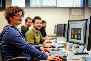
We also have an excellent GIS lab facility, with dedicated student computers, small classes, dual monitors, fast machines and a fun lecture/lounge area. Our instructors are very personable and genuine, adding to the positive learning environment. [grin]
Another really important bonus is our instructional/learner link to GIS research at the college and within our community. This is another area we are really proud of; our Selkirk Geospatial Research Centre (SGRC). It allows us to integrate real life projects and experiences into the classroom and often provides job opportunities for graduates.
GoGeomatics: What are the job prospects like out there for graduates of your program?
Tracey Harvey: Last year we had 100% job placement for our GIS programs! We have a co-op placement requirement which tends to get people the experience they need; it’s a great foot in the door which often leads to much more. Every year we have exciting jobs come through our co-op program, which is a real bonus for our students. We work hard to find opportunities. GIS is a great field to get into. Please suggest people be in touch with me for more information if they are interested.
Thank you Tracey for taking the time for this second interview with GoGeomatics Canada.


Be the first to comment