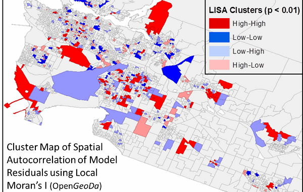
Is neighbourhood socioeconomic status associated with pediatric and childhood injuries? Are such injuries clustered in space? How can I model the spatial dependence in pediatric and childhood injuries in order to help policy makers develop effective and targeted prevention strategies to reduce injury occurrences in high risk areas? The above is but one example of the type of research questions addressed by students taking the Spatial Epidemiology and Disease Outbreak Detection course offered within the suite of the Professional Specialization Certificate in Population Health Data Analysis (PSC in PHDA).
Population health research is inherently spatial and firmly rooted in the connections between people, place, time and related socioeconomic drivers. Geography has become an increasingly recognized framework in this field, and GIS is a powerful tool for improving the understanding of data through visualisation and analysis for planning, monitoring and surveillance purposes.
The online Spatial Epidemiology and Disease Outbreak Detection course focuses on essential skills to do this kind of work. Students learn how to:
- visualize spatial data
- perform exposure assessments
- evaluate spatio-temporal disease clusters
- conduct small area health studies
- incorporate spatial parameters into models for specific health analyses.
Anders Erickson, the instructor of the Spatial Epidemiology course offered within the suite of certificate courses, sees real benefits in the program design and specialized course content:
“With the emergence of Big Data and a hyper-connected digital, social and physical world, spatial analysis has never had as much promise nor has it ever been as accessible as it is today; and we are just starting to scratch the surface of the potential applications. Therefore, having knowledge of different kinds of spatial data, geographic information system methods and the necessary skills to critically interpret and assess spatial analyses is a real asset.”
The PSC in PHDA Program is designed in collaboration with a multi-university research platform and is a fully online, practice focussed training environment that mirrors and supports many of the day-to-day skill development needs of health and social science researchers. The multidisciplinary focus of this specialized training program attracts a diverse range of health research professionals that bring a wealth of experience and knowledge to share with their online colleagues, supporting a rich, practice-based education and skills development environment.
PHDA04: Spatial Epidemiology and Outbreak Detection will be offered in September 2016. For more information, please visit continuingstudies.uvic.ca/population. To learn more about what our students are saying about their program experience visit the Population Data BC website.


Be the first to comment