 Underground infrastructure forms the backbone of modern cities, yet its management poses significant challenges worldwide. From safety hazards to substantial financial losses, the absence of accurate mapping and efficient data-sharing systems is a pressing issue. In North America alone, underground utility lines are struck every minute, causing widespread disruptions and contributing to an annual economic toll of over $91 billion.
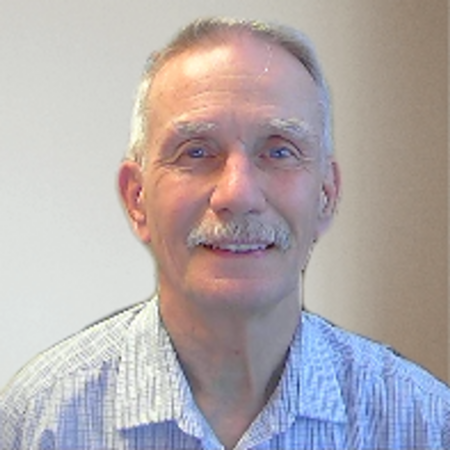
In this interview, Steve Slusarenko, Director of the Subsurface Utility Map Data Exchange (SUMDEx), discusses the critical need for mapping underground utilities, the transformative power of technology, and how SUMDEx is driving safer, more efficient infrastructure management.
Let’s start by addressing the core issue – why is mapping underground infrastructure such a critical problem today?
The lack of accurate maps showing the precise location of underground infrastructure is critical because it directly impacts the safety, costs, and efficiency schedule of construction and maintenance projects.
In North America alone, the economic cost of inaccurate data is estimated to be $91 billion annually in the U.S. and at least $2–3 billion in Canada. Globally, the costs are even higher.
The inefficiencies of using outdated systems are staggering. The root cause is that we often don’t know accurately where underground facilities are located. Records can be outdated, misplaced, or simply incorrect. It’s a case of “out of sight, out of mind.” People either don’t know about these utilities or rely on maps that haven’t been updated in years.
Many cities still rely on paper maps or PDFs, which cannot be integrated with modern GIS systems. Meanwhile, someone strikes an underground utility line every minute, causing disruptions and, in some cases, serious injuries or fatalities.
This inaccuracy has far-reaching consequences. It is estimated that over 60% of cost overruns on construction projects worldwide are due to last-minute discoveries about underground utilities. Construction often begins based on existing maps, but when discrepancies or unexpected obstacles are found, the project has to go back to engineers and architects. This causes massive delays and significant cost overruns.
Take Japan, for example. They experience only about 140 line strikes annually – roughly one strike per million people. This low number is due to their excellent mapping systems and rigorous protocols. In Canada, we report 10,000 strikes annually, or 260 per million people. In the U.S., it’s even worse, with 330,000 strikes annually, translating to 690 per million people.
The key difference lies in data management and mapping quality. Japan excels in this area because they maintain excellent maps and adhere to rigorous protocols, which we aim to replicate in North America.
Those statistics are eye-opening. What role does technology play in tackling this problem?

Technology is a transformative tool in addressing this issue. Today, we have technologies to capture the precise location of marked utilities and plot their precise location using Global Positioning SSystems. This allows us to update maps accurately and send corrected information to utility owners.
If discrepancies are identified, they can be investigated and resolved, enabling maps to be certified as accurate. Our goal is to reach the same level of accuracy as Japan, with far fewer line strikes, by creating accurate, up-to-date maps.
For example, in Burnaby, Canada, a pipeline had been misrepresented on maps for over 50 years. In 2007, an excavator operator relied on these maps and accidentally punctured the pipeline, thinking he was hitting a rock. Oil sprayed into homes and even reached the ocean, causing enormous societal and financial costs. Thankfully, no one was injured.
Modern tools such as satellite imaging, ground-penetrating radar, and advanced mapping software help us correct these discrepancies, prevent future incidents, and improve infrastructure projects’ overall safety and efficiency.
Can you explain how SUMDEx works and what makes it unique?
SUMDEx acts as a conduit for sharing underground utility map data. In North America, we have one-call centers that manage tickets for locating utilities. These centers notify utility owners, who then send crews to physically mark the ground.
We enhance this process by enabling utility owners to share their data electronically. This data is plotted on a common base map, allowing field personnel to verify its accuracy and identify any discrepancies. What’s important is that utility owners retain full control over their data – they only share what’s necessary for a specific request.
Our approach streamlines the process, eliminates redundancies, and ensures that maps are updated in real time. This benefits everyone involved, including utility owners, project owners, contractors, and the public.
So, do you own the data at any point during the process, or are you just a facilitator like, say, the postman?
We’re like the post office – facilitators, not owners. We deliver data between parties without altering it.
Why hasn’t such a system been implemented on a larger scale before?
The technology to support this process is now available and no longer an issue. Two main barriers remain: cost and reputational concerns. Implementing these systems can seem expensive, especially for smaller utility companies. Additionally, some companies worry that acknowledging inaccuracies in their records could harm their reputation.
To address these barriers, we’re offering the solution for free across North America. The goal is to encourage adoption by demonstrating how it saves time, money, and lives in the long run. As for the concerns regarding old records, it is better to be seen as resolving the issue rather than denying it by sweeping it under the rug.
Are there any challenges around data security and sharing?
Definitely the U.S., for instance, Homeland Security classifies certain infrastructure details as Sensitive Secure Information (SSI). In all cases, the infrastructure owner controls access to and the content of the shared information.
Our system mitigates access to information risks by ensuring only certain users – such as engineers, locate service providers, or emergency responders – can request utility location data. By working through one-call ticket systems, we balance the need for security with the requirement for accurate mapping and damage prevention.
Collaboration seems to be a key element of SUMDEx. How do you navigate working with so many stakeholders, including governments and utility companies?
Collaboration is central to what we do. Every state and province in North America has one-call centers that manage tickets for requesting utility locates. We leverage their existing systems. When someone files a one-call ticket, that organization facilitates communication between field teams and utility owners. We’re simply supplementing this process by using the tickets to request, send, and receive map data electronically.
We also collaborate with various departments. For instance, I recently spoke with Minnesota One-Call, which is building software for this. Their first phase is 96% nearing completion, and they’re working on documentation and performing beta testing. Phase two will focus on field data collection and sending that information back to utility owners.
Initially, I thought we’d have to develop this software ourselves. However, after reaching out to the Minnesota team, they offered to provide their solution for free and collaborate with us. This allows us to shift our focus from development to marketing, implementation, and user support.
So, you’re vendor-neutral, working as an NGO funded by various governments or organizations?
Exactly. The goal is to reduce utility companies’ costs, which ultimately benefits consumers. When utilities have accurate data, they can avoid damages and reduce repair costs. Fewer damages also mean lower societal costs, such as fewer traffic disruptions, less lost business, and reduced need for evacuations.
And let’s not forget abandoned utilities — those without owners. These pose a unique problem because they aren’t recorded or maintained by anyone. It’s challenging, but with proper mapping and regulation, we can start to account for them.
You mentioned earlier that this initiative has a global focus. What’s next for SUMDEx?
We’re looking to build partnerships with stakeholders around the world, including regulators, technology innovators, and governments. Regions like Flanders, for instance, already have advanced systems in place, and we continue to learn from their approaches and integrate those insights into our efforts.
Our long-term goal is to establish a global standard for subsurface utility mapping. This includes advancing technology and fostering regulatory frameworks that encourage accurate and transparent data sharing.
The scale of this challenge is massive. What kind of impact do you envision SUMDEx having?
The potential impact is enormous, both economically and socially. As I mentioned earlier, line strikes cost billions annually. Beyond the obvious direct financial and human costs of an accidental contact with a dangerous utility, there are significant societal impacts, such as traffic disruptions, lost business, and evacuations.
By adopting electronic data-sharing systems, cities can eliminate inefficiencies and reduce costs. For example, one city saved $130,000 annually simply by automating its data-sharing process. Now imagine scaling that impact globally.
Ultimately, SUMDEx aims to create a safer, more efficient system for managing underground utilities. This approach will prevent accidents and drive innovation and sustainability in infrastructure projects worldwide.
You’ve also been involved with the Subsurface Mapping Standards Forum (SUMSF). Can you tell us about the vision behind SUMSF and your role in its development?
SUMSF was envisioned by Geoff Zeiss, a highly respected expert in the geospatial and utility mapping space, who was deeply passionate about addressing the challenges of underground utility management. Geoff believed in the importance of creating global standards for subsurface mapping to ensure safer and more efficient management of underground infrastructure.
The vision behind SUMSF is to establish a unified framework for subsurface utility mapping, one that improves data accuracy, promotes efficient data-sharing practices, and enhances safety across industries. Geoff’s work in this area helped to highlight the need for collaboration and consistency, and his vision continues to guide the forum’s efforts.
My role has been to help facilitate discussions and bring together diverse stakeholders, aligning them around these shared goals. SUMSF and initiatives like SUMDEx represent a significant step forward in making utility mapping more reliable, consistent, and accessible globally. It’s an honour to carry forward the work Geoff was so passionate about and to contribute to this important initiative.


Be the first to comment