
Indigenous Mapping Conference Offers New Skills
Last week was the 6thannual Indigenous Mapping Workshop. This year’s event was in Inuvik, N.W.T, and hosted 75 individuals from all over the globe.
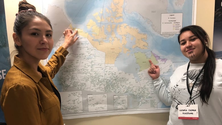
The purpose of this annual event is to advance the local and traditional knowledge for the purposes of hunting and the effect of climate change. To ensure the proper education of the delegates in regards to this topic, Google and Esri Canada provided the GIS software and programs. Steve DeRoy, the director of the The Firelight Group had this to say about the event; “What we’re trying to do is say, ‘here’s a suite of tools you might use to solve those problems that you might be facing.’”
Indigenous mapping conference giving attendees new on-the-land skills
Launch of Institute for Earth and Space Exploration
On Monday October 7th2019, faculty, staff and student gathered at Western University for the official launch of the Institute for Each and Space Exploration.
The Director from Western Space, Gordon Osinski, had this to say ;“Western has long been home to several extraordinary research groups, including the Centre for Planetary Science and Exploration, actively investigating different aspects of Earth and space exploration… With the creation of Western Space, our goal is to be Canada’s indisputable leader in Earth and space exploration research and training. This may sound ambitious but it is attainable as we have more than 60 researchers working together across eight faculties and 19 departments – a critical mass unrivaled in this country.”
.Western to officially launch Institute for Earth and Space Exploration
Teranet & Nearmap Announce Partnership
On October 10th2019, Ternanet Inc. announced its partnership with Nearmal Ltd. This partnership will allow Teranet to deliver new products to the market that will aid in their competency in terms on reliable land and property data while aiding Nearmap in terms of imagery products.
The VP of Commercial Solutions at Teranet said; “We are very excited about this partnership. Combining Nearmap’s advanced imagery capabilities with Teranet’s expertise in real estate and property insights creates so many possibilities for our organizations”.
Teranet & Nearmap Announce Partnership
N.B Municipalities Using Tech To Make Their Cities Smarter
Black Arcs, Inc. a Fredericton based company, has created a simulated map of Moncton. This interactive touch screen map is based on real data on everything from bus services to greenhouse gas emissions.
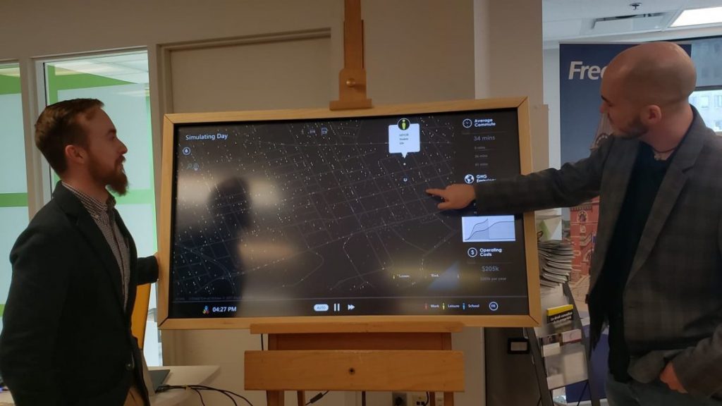
This tech will allow citizens to interact directly with the municipality and will aide in future development.
This project is one of three presented during the Future Cities Canada program last week. This date will help in the development of future public transportation systems and will allow citizen to self-serve from their own devices and stay up to date.
How These N.B. Municipalities Are Using Technology To Make Their Cities Smarter

Be the first to comment