
Dramatic growth reported in glacial lakes – A study by University of Calgary
Dr. Dan Shugar, an associate professor at the University of Calgary and the lead researcher for this study, along with his team of researchers, found a 50 percent increase in the volume of water in glacial lakes since 1990. This study, said to be the largest study of glacial lakes ever conducted, is a collaboration of Governments and Universities in Canada, the United States and the United Kingdom. The research supported by NASA’s High Mountain Asia program, has used supercomputing abilities and hundreds and thousands of satellite images from NASA and Google Earth, to analyze three decades of glacial lake boundaries.
Credits: NASA
Engaging Canadian Youth in the Space Sector

Canada’s new youth representative as the chief science advisor, Max King has ambitious plans for engaging Canadian youth in the emerging space sector.
Canadian Government’s current commitment to align Canadian space efforts with the U.S. on the Gateway program will help provide a stable foundation for the Canadian space sector, allow new space start-up companies to emerge, and provide excellent opportunities to young graduates.
source : Youth science advisor sees space as a key for Canada’s economy
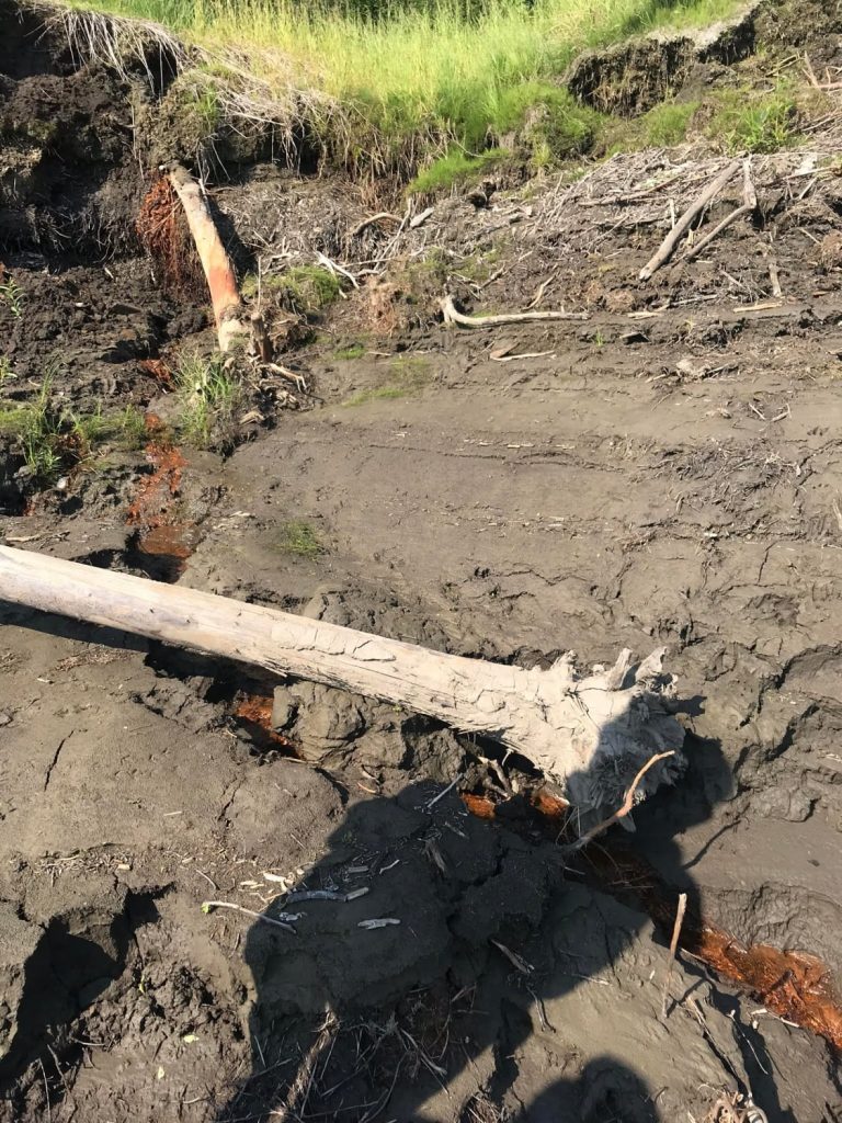
Remote Sensing analysis to help solve curiosity about Orange dust in Mackenzie Delta Region
An orange hue in waterways of Mackenzie Delta region (Northwest Territories) has Department of Environment and Natural Resources investigating the exact reason for it. There have been three theories so far; Iron bacteria, spruce rust or algae. C-CORE, a non profit organization, will perform Remote Sensing analysis and investigate the exact cause.
source : https://www.cbc.ca/news/canada/north/orange-colour-mackenzie-delta-water-1.5693749/
Artificial Intelligence plays important role in Digital Agriculture
Digital Agriculture researchers at University of Saskatchewan Saskatchewan (USask) are leveraging artificial intelligence to make crop production more efficient in Canada and around the world. They are part of a new Protein Industries Canada (PIC) consortium; which is one of Canada’s five innovation superclusters.
Calgary Woman’s Crowdsourced heartfelt Story Map of Alberta Parks
When the Alberta government announced its intention of partial/full closure of some parks, Calgarian Tanya Yeomans decided to make a map of the parks affected. She set up an anonymous survey for Albertans to share their park tales, stories and emotions attached to these parks and set them up as pop-ups on the interactive Alberta Park Stories map.


Be the first to comment