
Are you living in a smart city?
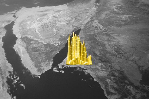
Smart cities are more than just flashy tech; they are made up of technology-based infrastructure, environmental initiatives, purposeful urban planning, high-functioning transit systems, and citizens willing to engage with the resources. They also require local government eager to act as a platform and facilitate webs of partnerships and contractors and outsource the operations that help the community run. You may already be living in a smart community: cities like Tokyo, Reykjavik, Singapore, and Toronto rank as some of the world’s smartest cities of 2018.
EU’s AURORA monitors MAJOR environmental risks
The AURORA project—funded by the European Union—is set to turn data from the satellites of the Copernicus program into information that will help European citizens. Sentinel-4 and Sentinel-5 will monitor ozone in the Earth’s atmosphere, as well as deploy tools to help cities mitigate air pollution and levels of ultraviolet radiation. The AURORA team will combine geostationary and low Earth orbit high-resolution sensor data to create real-time models of health risks and turn this information into recommendations for city officials.
Game-changing tech from Ordnance Survey
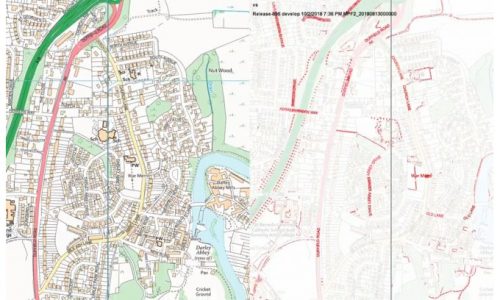
Ordnance Survey’s OS VectorMap Local, a fully-automated product derived from large-scale source data, was recently released to customers. The new OS is designed to trust the data source, use commercial off-the-shelf tools, create full end-to-end automation, and deliver data quality that meets the needs of the end user. The VectorMap Local will increase currency of data, reduce production time and increase speed to market, improve production and product quality through fully automated data processing at national scale, and increase consistency of output data of both contextual and analytical products. OS VectorMap Local is the first fully automated product derived from large-scale source data.
Using and protecting our location data
Location data is increasingly at the centre of tech trends and business models—as are concerns regarding privacy. To help consumers bridge the gap between opportunity and security, tech providers are laying measures to mask data and conceal individual user identity. One major tactic for protecting location-specific data is aggregation: by combining data on many users and masking individual identities, companies can harness data on consumer behaviour while also keeping the data private. Data aggregation is one of many strategies that businesses will need to consider in order to protect their customers as AI, machine learning, GPS and the Internet of Things provide more real-time information on who—and where—we are.
Smart cities and Point Clouds

Point clouds are essential tools for data integration with 3D city maps, and a major part of smart city infrastructure. Creating a smart city starts with an accurate 3D map of the entire area; any inaccuracies will impair decision making. Airborne LiDAR , photogrammetry, and mobile laser scanning systems create the 3D geodata that becomes an aid for water and sewage management, development, and more. But the tech is just the start: No geodata or 3D map can be used unless it is in the hands of professionals who can transform the data into information which supports the community’s goals and needs. Smart cities require smart tech and smart GIS analysts.


Be the first to comment