European Space Agency
Canadian Geospatial Digest for Jan 29th, 2024
Did you know about Canada’s tundra fire? A new digital map will facilitate the deployment of autonomous vehicles Launch day…
International Geospatial Digest October 23rd, 2023
Israel-Gaza Conflict: Maps, Charts, and Geospatial Updates Reviving Jaguars: A Conservation Triumph in Argentina’s Iberá National Park Through GIS Technology…
The ESA Offers Funding for Canadian Space-Related Innovations
The Canadian Space Agency (CSA) has opportunities to get funding for “early-stage” space-related” development programs and research. The ESA (European…
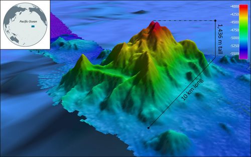
International Geospatial Briefing Nov 22: 1. Two million square km of the seafloor mapped. 2. Importance of marine geospatial data. 3. Using smartphones to map road potholes. 4. Into the metaverse. 5. The Geography of Mysteries. 6. Mapping our human footprint.
NOAA Ocean Exploration Meets Major Mapping Milestone on NOAA Ship Okeanos Explorer The National Oceanic and Atmospheric Administration (NOAA) has reached…
Canadian Wildfire Mapping Resources 2021 Fire Season
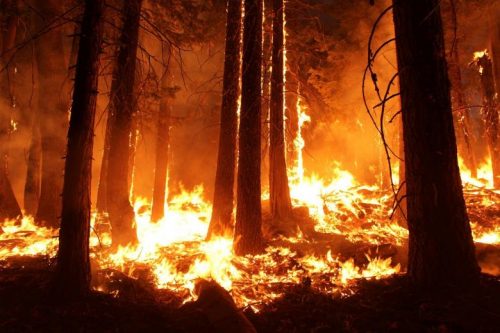
Western Canada has been experiencing extreme fire conditions following an intense heatwave since late June. According to BC Wildfire Service,…
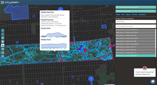
Your International Geospatial Briefing for August 17th: NZ Government investment in agritech; AWS unveils new space business segment; Measure local parks using geospatial data; Amazon rainforest cleared in July in Brazil; ESAIL Maritime Sat ready for launch
Government to invest $11.4 million in agricultural technology The New Zealand government undertakes investment in developing the country’s agritech sector,…
Your Global Geospatial Briefing for November 19th: EU AURORA project; protecting location data; Ordnance Survey tech; smart cities and point clouds
Are you living in a smart city? Smart cities are more than just flashy tech; they are made up of…
Your Global Geospatial Briefing for July 3rd: EU space program; Continental Mapping Consultants; trajectoryXyzt; CIGAR; Pakistan’s SAR satellite; Airbus/Planet partnership
The European Commission to spend $18.6B on space program The Galileo and European Geostationary Navigation Overlay Service (EGNOS) satellite navigation…
Free Satellite Imagery For You: Sentinel 1 & 2
Sentinel constellations and data products As the ENVISAT program is coming to an end, the European Space Agency has begun…
New Galileo navigation system is experiencing clock failures
Since December 15, 2016, the new Galileo global satellite navigation system has been up and running. Unfortunately, there are…
A Refreshing Approach to Geomatics
The conference committee of the GIM International Summit has announced a refreshing list of inspiring and original speakers who will…
Canada Day Came Early at the Canada Aviation and Space Museum
June 23rd marked a special day in the history of aviation and space in Canada. A very special aircraft, a…


